
Last Updated on 10/10/2025 by Louise
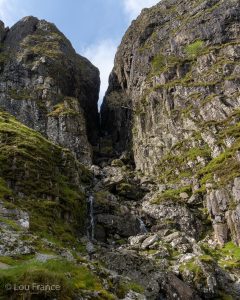
The Devil’s Kitchen refers to a large crack in the cliffs along the southern side of Cwm Idwal, between the mountain peaks Glyder Fawr and Y Garn. Through the crack, there flows a multi-drop waterfall.
In Welsh The Devil’s Kitchen is known as Twll Du, meaning Black Hole. The Devil’s Kitchen gets its name because when water or steam rises up through the crack, it resembles smoke rising up from a chimney.
Legend dictates that when steam is rising from the chimney, the Devil is cooking!
Disclaimer: Some links in this article are affiliate links, which means that if you purchase through them I receive a small commission, at no extra cost to you. This helps me cover the cost of running this blog. Thanks for your support!
Where is the Devil’s Kitchen and How do I see it?
The Devil’s Kitchen is found in Cwm Idwal (Idwal Valley) in Snowdonia/Eryri National Park. Cwm Idwal, with it’s tranquil lake and rugged surrounding peaks, is arguably one of the most picturesque areas in Snowdonia.
Cwm Idwal is just one area of the popular Ogwen Valley, which is banked by the Glyderau mountain range to the south and the Carneddau mountain range to the north.
Along the length of the valley runs the A5 which has multiple lay-bys for parking and a Visitor Centre with paid parking, toilets and a cafe.
In order to get good views of the Devil’s Kitchen, a mountain walk is required. Below I describe 4 great walks of varying lengths, all of which pass near to this evocative narrow gorge.
All of these walks begin from the Ogwen Visitor Centre on the A5.

4 Hikes To Explore The Devil’s Kitchen
1. Cwm Idwal and The Devil’s Kitchen Loop Walk
- Distance: 5km / 3 miles
- Elevation Gain: 334m
- Time: 1.5-2 hours
- Starting Location: Ogwen Visitor Centre
This is the shortest and easiest Devil’s Kitchen walk.
From the Visitor’s Centre there is a well made stone path leading to Cwm Idwal. The path begins with a beautifully forged metal gate and picturesque waterfall.
The path gradually climbs up through the valley and onto a plateau to reveal the very scenic Llyn Idwal (Lake Idwal). Paths run along both sides of this lake to make a complete loop.
Take the path to the left along the east shore and pass under the Idwal Slabs where you can see climbers picking their way up the craggy rock. Continue with the ascent up towards the boulder field.
Did you know? The Idwal Slabs were used as a training ground for Everest climber, Sir Edmund Hillary.
At the boulder field be careful to look out for the path that descends back to Llyn Idwal, otherwise you will continue to climb up to the plateau above. From this junction you will have a close-up view of the Devil’s kitchen waterfall, as well as a beautiful vista of Cwm Idwal and Pen yr Ole Wen peak.
If you’re interested in hiking Pen yr Ole Wen, take a look at this guide!
After soaking up the views, descend the path to the western side of the lake and complete the Llyn Idwal loop. Then simply retrace your steps back to the Visitor Centre.

2. The Devil’s Kitchen and Y Garn Hike
- Distance: 7.2km / 4.5 miles
- Elevation Gain: 626m
- Time: 3 hours
- Starting Location: Ogwen Visitor Centre
This route ascends a path to the side of Devil’s Kitchen and summits Y Garn. For a detailed description of this route, see this Y Garn hiking guide.
The trail begins with a walk up to Cwm Idwal along the well marked path from the visitor centre. Upon reaching the lake, circle around to the right along the western shoreline. At the far end of the lake the path begins to ascend towards the Devil’s Kitchen, which you will see straight ahead of you.
Once the path meets a trail from the eastern side of Llyn Idwal, it becomes a little rougher and some boulder scrambling is required. You will then see the Devil’s Kitchen waterfall up close on the right.
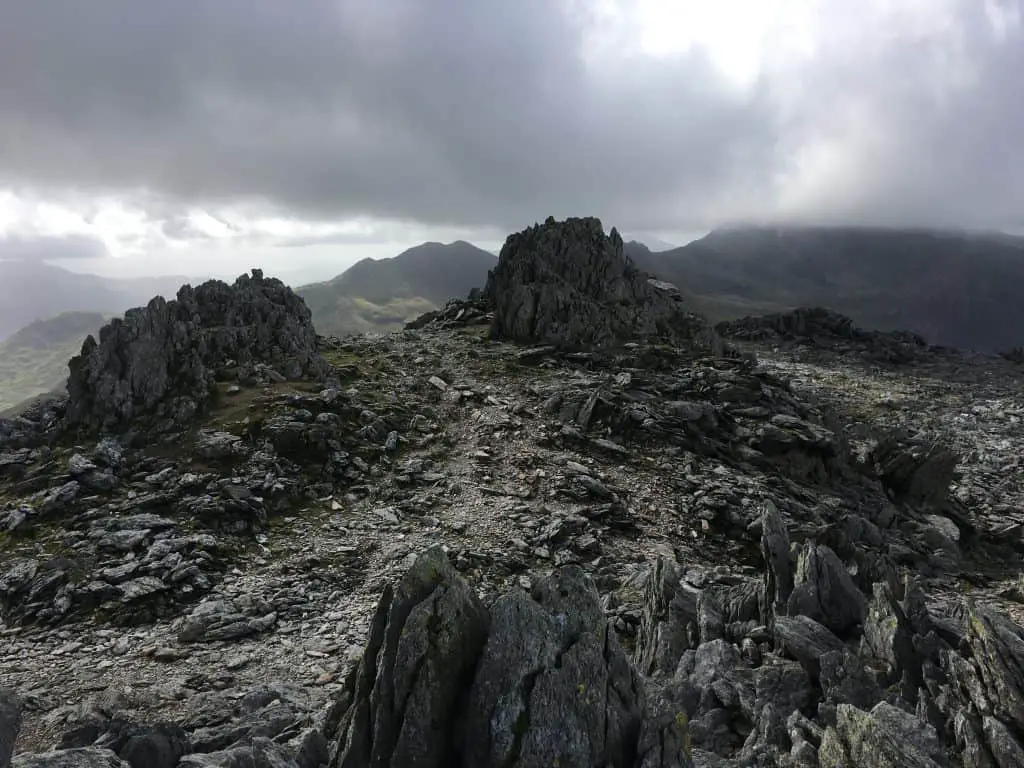
Continue to make you way up through the boulders and steep steps until you reach a fence. Climb over the stile and ascend through the chute, to a plateau where you will see a small lake, called Llyn y Cwn. This lake marks a crossroads for various other hikes including a steep scree ascent of Glyder Fawr (included in option 4).
Turn right, almost coming back on yourself as you now begin to climb Y Garn (there are two paths to climb Y Garn, with both leading to the summit cairn).
The ascent is fairly gradual all the way to the top. Soak up spectacular views from the top of Anglesey, Snowdon and Llyn Padarn before beginning your descent along East Ridge.
The descent is steep but easy to follow, leading back towards the north shore of Llyn Idwal. Just before reaching the lake a path branches off to the left which is a short cut back to the car park.

3. Y Gribin Ridge, Glyder Fawr and The Devil’s Kitchen Hike
- Distance: 7.3km / 4.5 miles
- Elevation Gain: 730m
- Time: 4 hours
- Starting Location: Ogwen Visitor Centre
This is a route for experienced hikers since it includes the grade 1 scramble of Y Gribin, as well as a descent of the Devil’s Kitchen, which can be tricky in wet conditions.
From the Visitor’s Centre begin along the well maintained path towards Cwm Idwal. At the junction, take the stone path which leads straight ahead towards Tryfan and Cwm Bochlwyd (the main stone path hooks around to the right and continues on to Llyn Idwal). Climb up alongside the river to Nant Bochlwyd.
Upon reaching the lake (Llyn Bochlwyd) turn right and begin the climb of Y Gribin. This climb starts as an easy grassy ridge that meanders upwards, however don’t be fooled as it then becomes a decent grade 1 scramble. Stay on the ridge proper for a tougher more exposed climb, with paths to the right hand side being an easier option.
The ridge tops out, not at a summit, but at Bwlch Ddwy Glyder (the saddle between Glyder Fawr and Glyder Fach).
The route can be extended here by turning left and scrambling up through Castell y Gwynt and on towards Glyder Fach.
Take the path to the right (west) to continue the ascent onto Glyder Fawr along a well trodden path. Enjoy this walk through curiously shaped rock formations until you reach the summit.
From the summit of Glyder Fawr, descend in a north westerly direction down a steep, loose scree path to the plateau below. Circle around the east side of Llyn y Cwn (the small lake) and down the chute towards the Devil’s Kitchen.
The descent through the kitchen is straightforward at first, however the path then becomes less obvious as you navigate the boulder field. The route is quite steep in parts, requiring a little boulder hopping and some easy level scrambling (or perhaps a little bum shimmying!)
Soon though the path becomes clear again as it splits into two, with paths passing around either side of Llyn Idwal.
Take the fork to the right to skirt the eastern side of the lake and follow the path all the way down to Ogwen car park.

4. Devil’s Kitchen, Glyder Fawr, Glyder Fach and Llyn Bochlwyd Hike
- Distance: 8km / 5 miles
- Elevation Gain: 855m
- Time: 5-6hrs
- Starting Point: Ogwen Visitor Centre
This route is a slightly longer variation of the route above, but includes the summit of Glyder Fach and bypasses Y Gribin Ridge. Here is a brief route description but for more detail, see this guide.
Follow the main path from the Visitor’s Centre to Cwm Idwal. Walk around Llyn Idwal and climb up through the Devil’s Kitchen to the Plateau above. Walk around the small Llyn y Cwn and ascend Glyder Fawr.
From Glyder Fawr continue onto Castell y Gwynt and Glyder Fach, before descending on the easy trail to the east. Follow the Miners track to Llyn Bochlwyd before returning to Visitors Centre.
Why not combine your visit to the Devil’s kitchen with a trip to one of Wales’ top castles? Discover the top castles to visit in North Wales here!
Be Prepared For Your Devil’s Kitchen Adventure
Before you attempt any of these hiking trails make sure you are properly prepared with both equipment and knowledge.
Check the weather forecast beforehand and then decide if the route is right for you on that day. Several of these routes have exposed edges and steep drops, which can be treacherous in wet, windy and foggy conditions.
Consider hiring a guide if you’re unsure.
Once you have chosen your route, make sure you have all the equipment you need. Here is a list of basic equipment needed to enjoy these fabulous walks.
- Suitable clothing: warm layers and waterproofs
- Water, food, snacks: filtering water bottles are very handy for safely refilling in streams and rivers. You can read more about filtering water bottles in this guide. Psst! I’ve secured a deal for all readers of this website. Simply use the code WWG15 at checkout to get a 15% discount off all Water-to-go bottles and filters.
- Quality hiking boots or trail shoes are a must
- The relevant map and compass, and the ability to use them!
- A first aid kit for hiking
- GPS or mapping app:A great free app option is maps.me, although the free features have now become limited. I have an annual subscription to OS which means I have access to all UK OS maps on my mobile. I can definitely recommend it if you’re a regular hiker/walker.
These are just some of the essentials, but for a complete list of things to take on a hike in Wales, take a look at this guide!
Where To Stay On A Trip To The Devil’s Kitchen, Wales
Accommodation options in Ogwen Valley itself are somewhat limited, but there are more options in nearby towns.
If you’re happy was a basic campsite try Gwern Gof Uchaf campsite. If you prefer glamping try Gwern Gof Isaf. These two campsites are located a few miles from each other and are easy to confuse, so be sure to double check directions before you set off. Or if you’re looking for a hostel, there is the YHA which is right next to the Ogwen Visitor Centre.
Just outside Ogwen Valley you can find the small village of Capel Curig. Here you can find the beautiful Carreg Cottage, which is perfect place to stay if you’re looking to have your own apartment to use as a base.
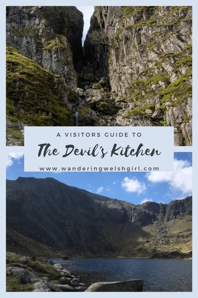
Like It? Pin It For Later!
Join My Newsletter Today!
Recent Posts
11 Best Waterfalls in South Wales (With Videos & Parking Locations): 2026 Edition
South Wales is a waterfall lover’s paradise. With ancient woodland, dramatic gorges, and mountain-fed rivers, this region boasts some of the UK’s most spectacular waterfalls. Tucked away in the...
The UK is a hiker’s paradise. With rugged coastlines, rolling moors, ancient forests, and towering peaks, there’s something for everyone—from seasoned mountaineers to casual weekend walkers. As...