Standing at 947m, Y Garn is one of the highest mountains in Wales. Y Garn is part of the Glyderau range of Eryri (Snowdonia) and one of the Welsh 3000s. From the summit of Y Garn, hikers can enjoy beautiful views in all directions, making it a popular destination for both sunrise and sunset walks.
There are a few ways to hike to the summit of this formidable peak, but the most popular and arguably best hike of Y Garn is via the Devil’s Kitchen from Cwm Idwal. This route involves an easy scramble up the Devil’s Kitchen and a steady ascent of the southern side of Y Garn, followed by dramatic descent of the northeast ridge.
This is a complete guide to hiking Y Garn via the Devil’s Kitchen.
Disclaimer: Some links in this article are affiliate links, which means that if you purchase through them I receive a small commission, at no extra cost to you. This helps cover the cost of running this blog. Thanks for your support!
Y Garn Quick Facts
- Height: 947m (3106ft)
- Mountain Range: Glyderau
- Map: OS Explorer OL17
- How to Pronounce: Ur Garn
- Meaning: The Cairn
- Classification: Hewitt
- Weather Forecast: Met Office forecast
Y Garn Hiking Route Map
Click here for the route on OS Maps
Y Garn Hiking Route Description
- Distance: 7.2km / 4.5 miles
- Elevation Gain: 670m
- Time: 3 – 4 hours
- Starting Location and parking (paid): Ogwen Visitor Centre
- Difficulty: Strenuous
This walking route begins at the Ogwen Visitor Centre. Here you can learn a little about local mountain geology, use the toilet facilities and stock up on last minute snacks for the journey. Parking at the visitor centre is pay and display and fills up fast. There is alternative parking available in laybys located along the A5.
From the Visitor Centre there is a well defined stone path that leads up to Cwm Idwal. Enjoy the pretty cascades and beautiful iron gate which you pass through en route.
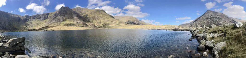
Upon reaching the lake, take a moment to enjoy the scene that opens up before you. On the right you will see the large peak of Y Garn, straight ahead you will see Glyder Fawr and to the left you will see Tryfan. Not only is this one of the prettiest areas of Eryri (and of Wales in general), but it’s also a very unique area for learning about geology and ancient flora and fauna.
At this point you can walk around either shore of the lake to reach the ascent to Devil’s Kitchen on the far side. I prefer to walk around the left (eastern) side of the lake, looking out for climbers making their way up the Idwal Slabs.
As the path rounds the southern end of the lake it begins to climb gradually, before turning left to climb directly up along the Devil’s Kitchen.
Did You Know? The Devil’s Kitchen or Twll Du (Black Hole) in Welsh, is a large crack in the rocks between the peaks of Y Garn and Glyder Fawr. A multi-tiered waterfall known as the Devil’s Appendix flows down through the crack and at 93m in height, is the tallest waterfall in Wales. When steam rises up from the kitchen, the Devil is said to be cooking!
For all the hiking routes which take in the Devil’s kitchen, see this guide.

The scramble up alongside the Devil’s Kitchen is more of a boulder clamber than a technical scramble and is fairly straight forward to navigate. Although extra care should be taken when the rocks are wet and slippery.
At the top of the boulder field there are some big steps that lead to a fence and mark the end of this steep section. Climb over the stile and ascend through the chute, to a plateau where you will see a small lake, called Llyn y Cwn. This lake marks a crossroads for various other hikes including a steep scree ascent of Glyder Fawr.
For detailed descriptions on all the hiking routes to Glyder Fawr, see this guide.
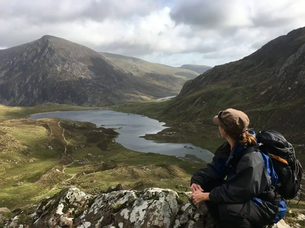
Turn right before the lake, almost coming back on yourself as you cross the stream and begin to climb Y Garn itself. This well-trodden path is a steady walk all the way to the summit, hugging the shoulder’s edge in places and offering spectacular views of Ogwen Valley below.


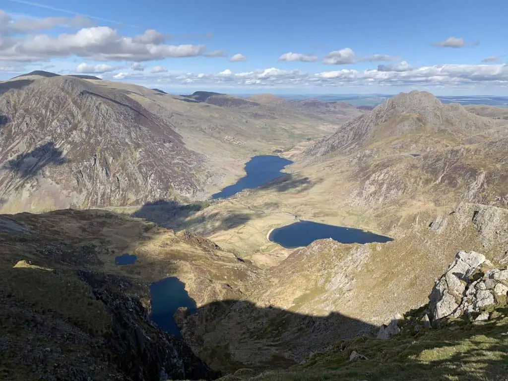
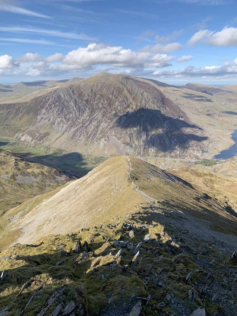
Views from the top of Y Garn are as fine as any in Snowdonia. To the northeast you can see the Carneddau with Pen Yr Ole Wen at front and centre, whilst Tryfan and Glyder Fawr dominate the Glyderau to the southeast. To the southwest you can pick out the peaks of the Snowdon range, whilst on clear days Anglesey is visible to the northwest.
When you’re ready to leave this mighty peak, follow the path to the north as it drops to a flat area, with a cairn marking the top of the northeast ridge. Turn right here. The ridge varies in steepness as you descend, providing ample opportunity to soak up the last of the views over Ogwen valley.
Just before reaching the lake the path flattens out and branches in two. Follow the path to the right to return to Llyn Idwal and its north shore beach, before retracing your steps back to the visitors centre.
Alternatively, take the less established path to the left, across wet ground which cuts through a delightful gulley before returning to the visitor centre.
A great end, to a great walk!
Read Next
- The 10 Best Hiking Routes In Snowdonia
- Top Locations For Photography in North Wales
- The Best Castles To Visit in North Wales
Where To Stay After Hiking Y Garn
Accommodation options in Ogwen Valley itself are somewhat limited, but there are more options in nearby towns.
If you want to stay close to the action, you can’t get much closer than the YHA Idwal Cottage located next to the Ogwen Visitor Centre on the A5.
If you’re looking for a nearby campsite try Gwern Gof Uchaf campsite which is situated at the base of Tryfan. If you’d prefer glamping try Gwern Gof Isaf. These two campsites are located within a few miles of each other and are easy to confuse, so be sure to double check directions before you set off.
Just outside Ogwen Valley you can find the small village of Capel Curig. Here you can find the beautiful Carreg Cottage, which is perfect place to stay if you want an apartment to use as a base.
Y Garn Walk Packing List
Here are some of the basics required for hiking Y Garn.
- Waterproofs – of course, it’s Wales and we get lots of rain!
- Food & water – filtering water bottles are very handy for safely refilling in streams and rivers. You can read more about filtering water bottles in this guide. Psst! I’ve secured a deal for all readers of this website. Simply use the code WWG15 at checkout to get a 15% discount off all Water-to-go bottles and filters.
- Hat, gloves and warm layers for the summits
- Quality hiking boots are a must
- The relevant map and compass, and the ability to use them!
- A first aid kit for hiking
- These paths are also marked on various mapping apps. A great free option is maps.me, although the free features have now become limited. I have an annual subscription to OS which means I have access to all UK OS maps on my mobile. I can definitely recommend it if you’re a regular hiker/walker.
These are just some of the essentials, but for a complete list of things to take on a hike in Wales, take a look at this guide!
Prefer not to walk alone? If you’re looking for a Mountain Leader to guide you on a mountain adventure, please contact me at [email protected] to discuss rates and availability.
Final Thoughts On This Y Garn Walking Loop
Y Garn is a peak in the Glyderau range of Snowdonia in North Wales. It is the 11th highest mountain in Wales and one of the Welsh 3000s. The best Y Garn hiking route ascends through Cwm Idwal and the Devil’s Kitchen and descends via the northeast ridge. Walking Y Garn via the Devil’s Kitchen takes around 3-4 hours to complete and is considered strenuous due to the elevation gained.
Join My Newsletter Today!