
Last Updated on 29/12/2025 by Louise
Waun Fach (Little Moor) is a peat bog summit in the eastern part of the Brecon Beacons/Bannau Brycheiniog in South Wales. At 811m high, it is the tallest peak in the Black Mountains. The most scenic walking route to the summit of Waun Fach is a circular loop from Pengenffordd which incorporates Y Grib, a ridge commonly known as the Dragons Back.
This is a step by step guide to hiking Waun Fach including distances, times, photos and a video of the route.

Disclaimer: Some links in this article are affiliate links, which means that if you purchase through them I receive a small commission, at no extra cost to you. This helps cover the cost of running this blog. Thanks for your support!
Walks In The Black Mountains
The Black Mountains refer to an area of hills in the eastern part of the Brecon Beacons National Park, which form a natural hilly border between Wales and England.
This area is often confused with the western-most mountain range in the park called the Black Mountain. To confound matters even more, there is a mountain in the Black Mountains called the Black Mountain (Twyn Llech)!
There are many great walks in the Black Mountains but my personal favourite is this Waun Fach loop via the Dragons Back. This walking route provides a brilliant combination of history, ridge walking and long reaching views, all of which makes for an excellent mountain day in the Brecon Beacons.
Waun Fach Walk Overview & Video
This Black Mountains walk has no amenities and with no trees or shelter, is quite exposed for most of the route. There are several boggy sections so it can be quite wet and slippery after heavy rain. Whilst this is a relatively short walk, there is quite a lot of ascent through the first half of the route and it therefore shouldn’t be underestimated.
- Distance: 12 km/ 7.5 miles
- Time: 3.5-5 hours
- Elevation gain: 650m
- Difficulty: Moderate-challenging
- Starting Point: Castle Dinas Inn near Pengenffordd (A479). Parking fee: £2.
- Map: OS Explorer OL13 Brecon Beacons National Park
Waun Fach and The Dragons Back Loop Trail Description
This Waun Fach circular walk begins near the village of Pengenffordd, at the Dinas Castle Inn (formerly the Dragons Back Pub) car park on the A479. This is private car park who ask for a £2 donation in order to park for the day. There is a black donation box at the south end of the car park.


At the north east end of the car park there is notice board with a map of the Black Mountains. Just to the left of the notice board, public footpath signs point to the start of the walk. Head down the wooden steps and turn right onto a small bridleway. Follow this lane and almost immediately you will see a stile on your left. Cross the stile to access the field.

There’s not much time to get warmed up on this walk as the climbing starts right from the off! The path here is faint and follows the edge of the fields but keep heading directly uphill, looking for the stiles to keep you on track.
After crossing over two stiles and passing through one metal gate, you will see a metal gate with a public footpath sign pointing to your left. Ignore this gate and instead keep walking uphill, keeping the fence on your left-hand side. At the top of the field cross over one more stile and make the final push for the first point of interest on this walk.

The climbing eases off at the 400m contour, once you reach the ruined site of Castle Dinas (Castell Dinas). Here are the remains of an Iron Age hillfort and a Norman Castle that was once the highest castle in England and Wales.
Catch your breath here and take a little time to explore the old castle ramparts and earth covered walls.


Weather permitting, at this point you can see your entire walking route in front of you. Behind, to the southwest you will see the long flat ridge of Mynydd Troedd and glimpses of the Central Beacons beyond.
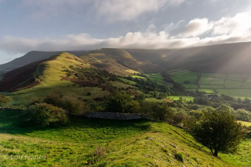
After a brief descent from Castell Dinas, the walk now begins climbing up the Dragons Back, so named because the ridge resembles that of a sleeping dragon. Follow the peaks and troughs of this ridge, admiring views in both directions as you ascend. Don’t forget to look back to admire views of the Central Beacons (providing the weather is clear).
The path along the ridge is obvious to follow. Easier side-spurs pass around the steep lumps and bumps, but the views from atop the crest are rewarding enough to stick with it.
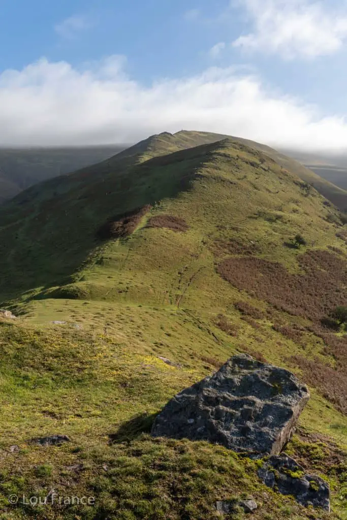

There is a rock cairn to mark the end of the ridge and the steepest uphill sections. From here the route gets a little boggy as you cross the plateau, but with a few hops and jumps the biggest puddles of mud can be avoided.
Take the fork to the right to ascend Pen Y Manllwyn, which is the flat ridge en-route to Waun Fach. There is another, shorter cairn here and the path becomes more defined and maintained. From this cairn you can see the ridges that make up the Ewyas Valleys Horseshoe from Llanthony Priory and the summit of Hay Bluff which marks the northeasterly corner of the Brecon Beacons.


From Pen Y Manllwyn cairn turn right and begin walking along the stone/gravel path. Heading in a southerly direction now, the path crosses a flat section before beginning the final climb of the day to attain Waun Fach summit.
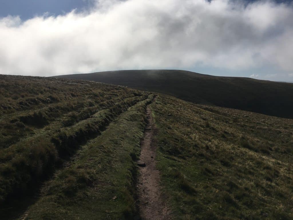
The summit of Waun Fach is a flat, featureless affair with a short flat rock acting as a trig point. Somewhat underwhelming considering this is the highest peak in the Black Mountains and the fourth highest mountain in the Brecon Beacons.
There are 360 degree views on offer but since the summit is so broad, views aren’t that dramatic. The best views on this loop are actually provided along the ascent and decent, rather than from the peak itself.


From the trig point, take the path to the right to descend in a westerly direction. This will be clear to see in good weather as the path is well defined, but it might require some map reading and compass work in poor visibility.

Follow the well-maintained path on a gentle decent enjoying views of the conical-shaped Sugar Loaf to the south, Pen y Fan to the west and Y Grib to the north. At the end of the plateau the trail becomes a little vague so keep to the left of the ridge to avoid heading off course. The path descends very steeply into the saddle between Pen Trumau and Mynydd Llysiau to reach a crossroads. At the crossroads take a sharp right onto the path that skirts back around the hillside.
Alternatively, at the end of the plateau, continue straight ahead down a path created by the quad bikes being used by workers to manage the peat bogs. This unofficial path heads directly down the hill before re-joining the marked path, effectively cutting the corner off the official path.


The route that descends the mountainside is a well-defined, rocky path which provides glorious views over the valley. At the bottom of the hill pass through several farmers gates, before reaching a tarmac road.
Struggling with all these Welsh words? Check out this guide where I explain how to get your tongue around the Welsh language and pronounce Welsh place names with ease!
Turn right onto the road, then take the left fork to follow the lane downhill past the riding stables and bunk house, before a steep climb back up to the left. Continue along the road to join up with a bridleway which leads through the forest, back to the car park.
Finish your walk with a drink or a bite to eat in the appropriately named Dinas Castle Inn, which is also the highest pub in the Brecon Beacons.
Related Reading
Where to Stay Near Waun Fach
The best place to stay for this hike is the quaint market town of Crickhowell. There are several boutique hotels and B&Bs on offer in and around Crickhowell.
Packing List for a Waun Fach Circular Walk
- Suitable clothing: warm layers and waterproofs
- Water, food, snacks: filtering water bottles are very handy for safely refilling in streams and rivers. You can read more about filtering water bottles in this guide. Psst! I’ve secured a deal for all readers of this website. Simply use the code WWG15 at checkout to get a 15% discount off all Water-to-go bottles and filters.
- Quality hiking boots or trail shoes are a must
- The relevant map and compass, and the ability to use them!
- A first aid kit for hiking
- GPS or mapping app:A great free app option is maps.me, although the free features have now become limited. I have an annual subscription to OS which means I have access to all UK OS maps on my mobile. I can definitely recommend it if you’re a regular hiker/walker.
These are just some of the essentials, but for a complete list of things to take on a hike in Wales, take a look at this guide!
More Hikes In The Black Mountains
- Hiking the Skirrid Mountain
- How to hike the Sugar Loaf
- Llanthony Valley Walks and Hay Bluff
- Hiking the Blorenge
Final Thoughts On Walking Waun Fach
Waun Fach is a broad peak and the highest mountain in the eastern part of the Brecon Beacons. The most scenic walking route to the summit of Waun Fach is a circular loop from Pengenffordd which incorporates Y Grib, a ridge commonly known as the Dragons Back.
Due to the amount of ascent, this can be considered a challenging route, although the views on offer throughout the entirety of this walk make it entirely worth it. A cracking mountain day in the Brecon Beacons!
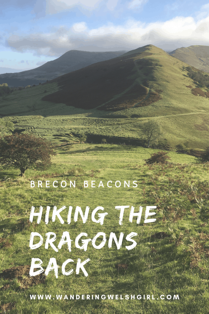
Like It? Pin It For Later!
Join My Newsletter Today!
Recent Posts
11 Best Waterfalls in South Wales (With Videos & Parking Locations): 2026 Edition
South Wales is a waterfall lover’s paradise. With ancient woodland, dramatic gorges, and mountain-fed rivers, this region boasts some of the UK’s most spectacular waterfalls. Tucked away in the...
Athens' modern-day charm might captivate many tourists, but its historic side, represented by the glorious Acropolis, is unmatched. This beautiful landmark is a powerful reminder of ancient history...