
Last Updated on 15/12/2025 by Louise
Hay Bluff, or Penybegwn in Welsh, is a mountain in the Black Mountains of South Wales. The mountain reaches 677m high and marks the northeastern edge of the Brecon Beacons National Park (Bannau Brycheiniog). The flat-topped peak of Hay Bluff also sits at the most northerly point of Hatterall Ridge, which provides a natural border between England and Wales.
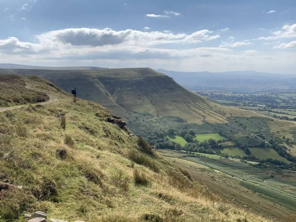
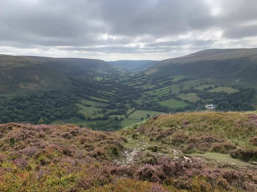
The steep escarpments on the northern flank of Hay Bluff provide dramatic views over the Wye Valley below and the edge of the Brecon Beacons range to the west. These breathtaking views make a walk of Hay Bluff well worth adding to your Beacons bucket list.
In this guide, I provide trail descriptions for 4 circular walks that take in the summit of Hay Bluff.
Disclaimer: Some links in this article are affiliate links, which means that if you purchase through them I receive a small commission, at no extra cost to you. This helps cover the cost of running this blog. Thanks for your support!
Hay Bluff Quick Facts
- Height: 677m (2,221ft)
- Area: Black Mountains
- Map: OS Explorer OL13 Brecon Beacons National Park map
- How to Pronounce: Penybegwn: Pen-er-beg-oon
- Meaning: Rounded top (peak)
- Classification: Deleted Nuttall
1. Hay Bluff Circular Walk
- Distance: 10km (6 miles)
- Time: 4 – 5 hours
- Elevation Gain: 421m (1390ft)
- Starting Point: Hay Bluff Car Park (Grid Reference SO239373)
- Difficulty: Moderate
- Summits: Hay Bluff, Twmpa
This is a fairly short walk of Hay Bluff that also includes the summit of Twmpa. There is a steep initial climb, followed by an easier ascent of Twmpa and a straightforward return walk.
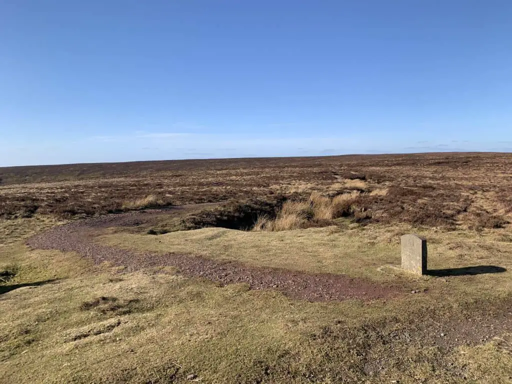
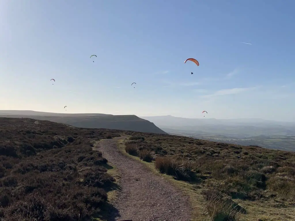
There is a dedicated parking area at the foot of Hay Bluff which can be reached by simply typing Hay Bluff car park into Google or clicking this link. From the car park, you will see Hay Bluff directly ahead of you to the south and the footpath that rises directly up its steep face.
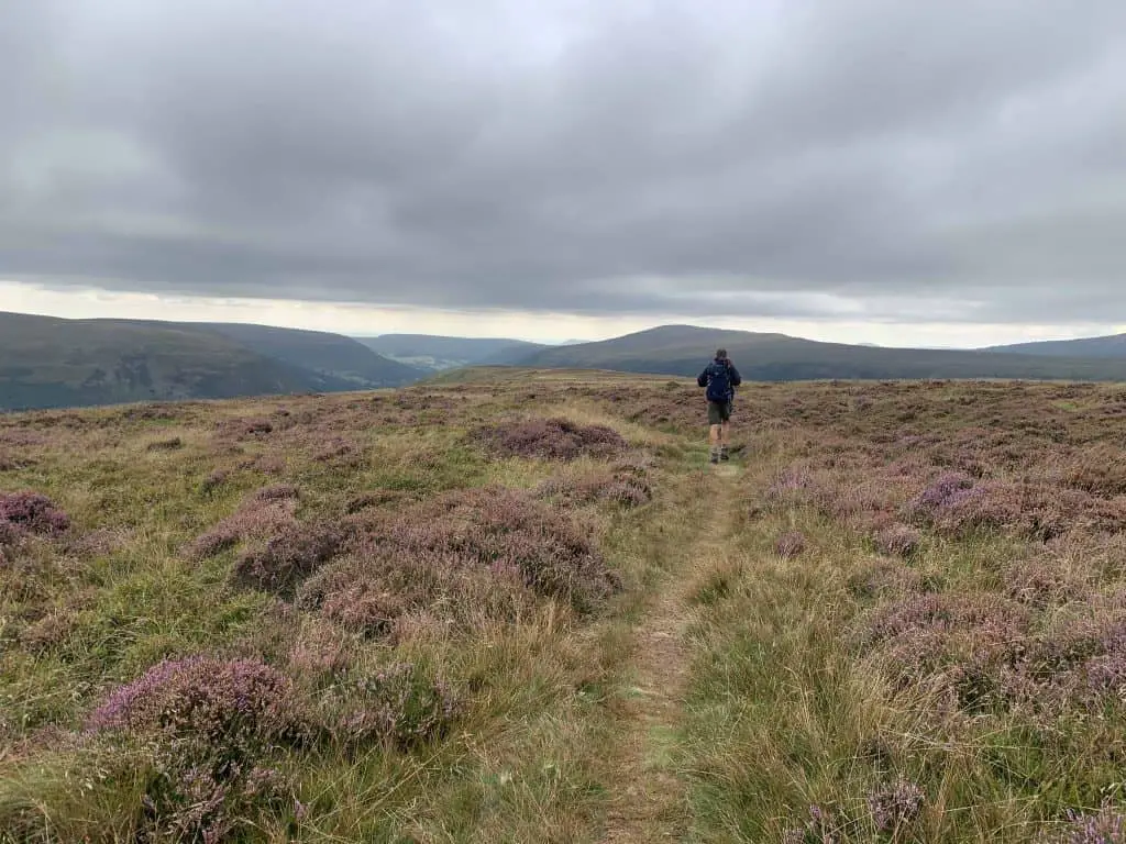
Head towards the escarpment and begin climbing the hill. Before too long the path turns to the right to begin following the contours of the mountain. (Alternatively, continue straight ahead, for a steeper and more direct hike to the summit).
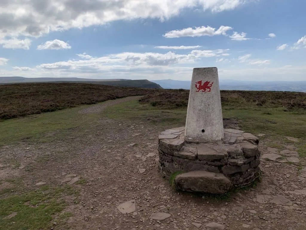
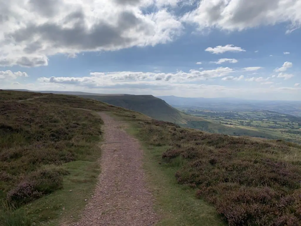
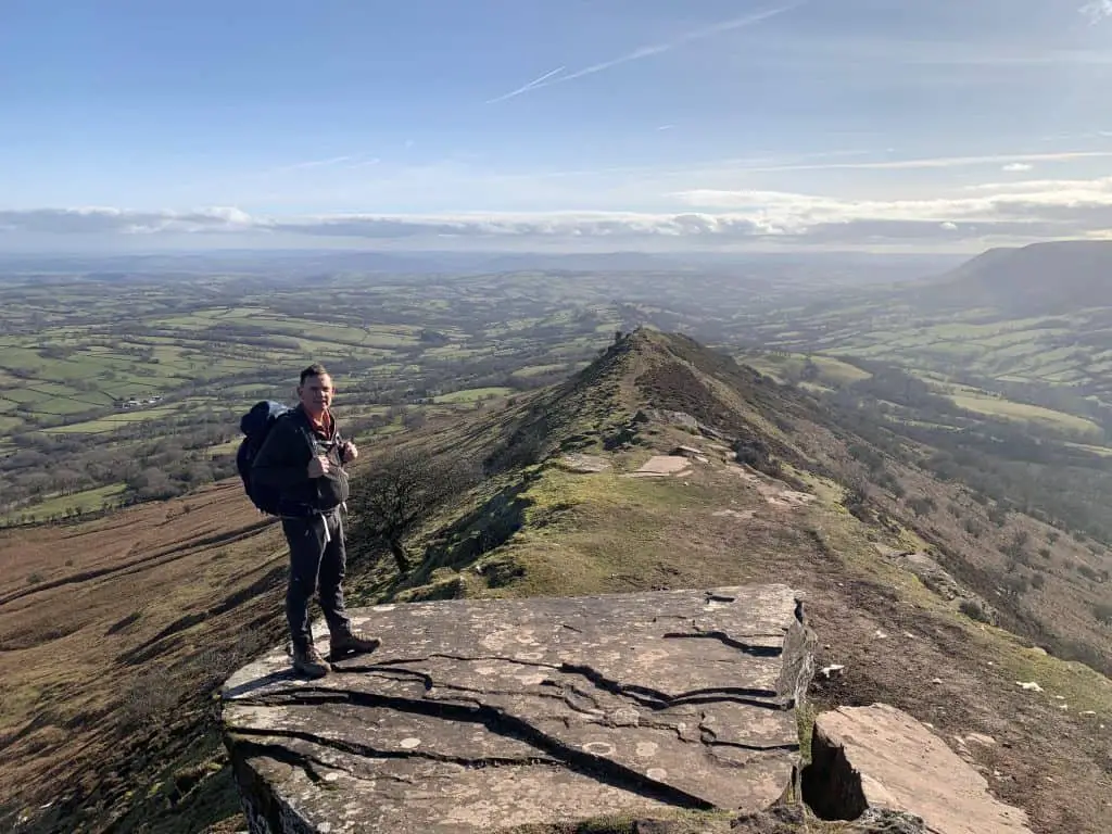
Once on top of the ridge, turn left to follow the path that leads to the summit trig point of Hay Bluff. Take time to soak up the up the dramatic views on offer from this Black Mountains peak. To continue the walk, turn back in the direction you’ve just come from, to walk along the edge of Hay Bluff.
This well maintained path heads in a southwesterly direction to descend into the col between Hay Bluff and Twmpa. These two peaks are divided by a country road known as Gospel Pass.
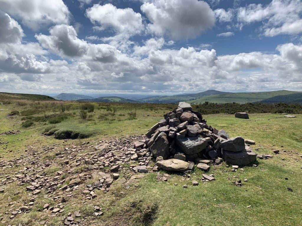
Cross over the road and begin climbing the next hill along the obvious grassy path. Where the path forks, take the path to the right which leads directly to the summit cairn (684m). Twmpa, also known as Lord Hereford’s Knob, is a fairly flat and wide summit, but still offers great views along the rest of the Brecon Beacons to the west.
With good visibility you will have views of Pen y Fan in the Central Brecon Beacons.

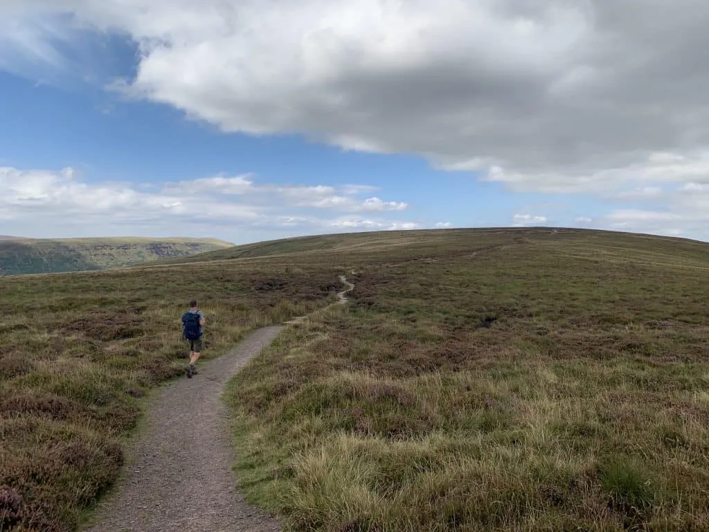
Leave the summit in a southeasterly direction to continue along the path towards the next peak of Rhos Dirion. The path descends into the saddle between the peaks and just as the path flattens out, branch off onto the grassy path to the right. The trail makes a sharp turn to begin descending the mountain in a northerly direction.
Continue along the path through the grassy fields and through the ferns as it heads back towards the parking area. After around 1.3km, you will join a country road. Turn right onto the road and follow it back to the starting point to complete the loop.
2. Hay Bluff, Twmpa and The Vale of Ewyas Loop
- Distance: 17 km (10.6 miles)
- Time: 5-7 hours
- Elevation Gain: 636m (2087ft)
- Starting Point: Gospel Pass Car Park
- Difficulty: Strenuous
- Summits: Twmpa, Hay Bluff
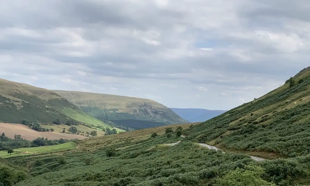
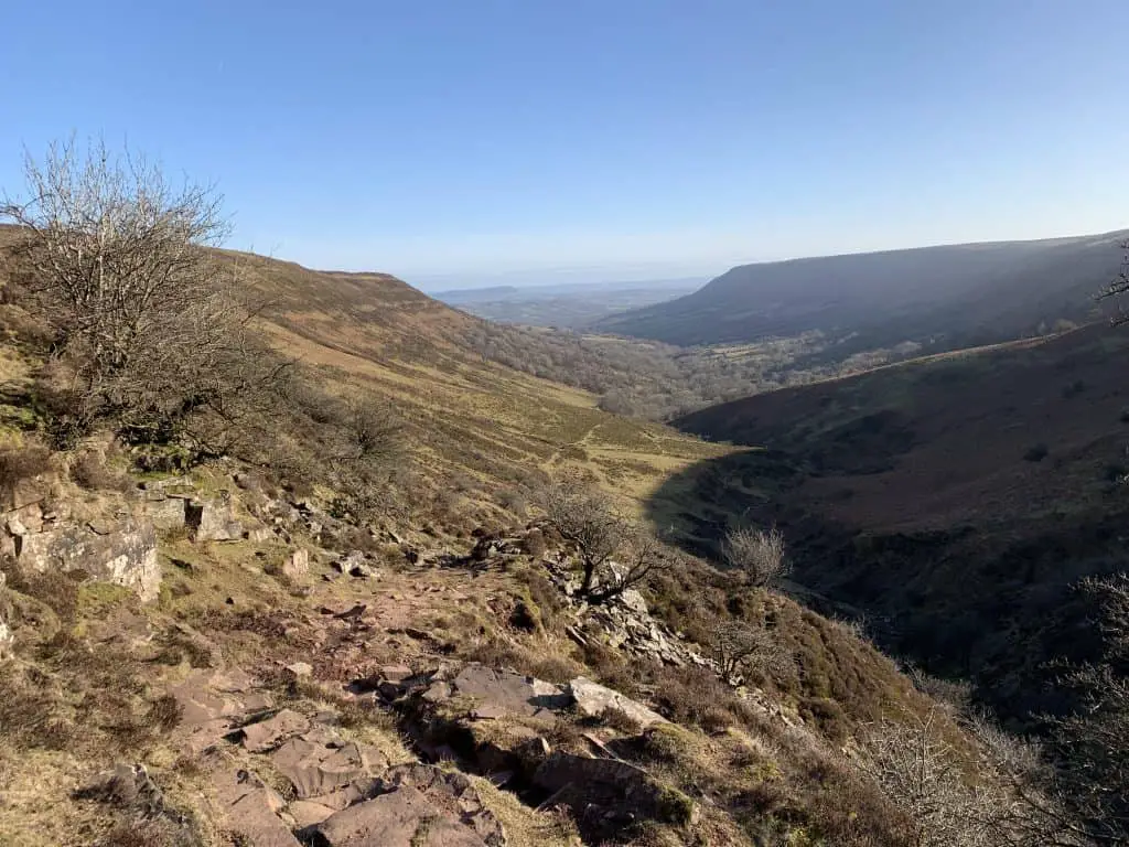
This is a fabulous walk that provides a traverse along the ridges of Twmpa and Hatterrall, and takes in the peaks of Hay Bluff, Twmpa and Mynydd Du (Black Mountain). The walk offers views over the Vale of Ewyas, Olchon Valley and the northern flanks of the Bannau Brycheiniog/Brecon Beacons range. For the variety of views on offer and without doing the full horseshoe, this is my favourite Hay Bluff walk.
From the car park at Gospel Pass, cross over the road to join the path leading in a southwesterly direction to immediately start climbing Twmpa (Lord Hereford’s Knob). There is no time to warm up as you begin the first climb of the day, though this isn’t as steep or strenuous as the second climb to come (130m vs 330m).
The path is well established and easy to follow. Where the path forks, take the path to the right which leads directly to the summit cairn (684m). Twmpa summit is fairly flat and wide but still offers great views along the rest of the Brecon Beacons to the west.
From the summit, ignore the path that leads westerly and instead take the less established path leading along the ridge in southeasterly direction. The journey along Twmpa is a long ridge walk which takes a very slight descent as you go. Enjoy the beautiful views of the Vale of Ewgas as they open up in front of you.
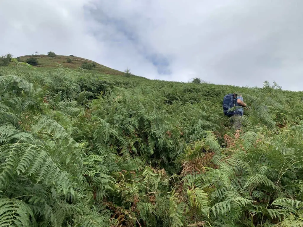
At the southern end of Twmpa ridge it’s time to descend into the valley. Just below the 500m contour, look out for a sharp left turn which crosses through the ferns before making a sharp right turn to continue descending the base of Twmpa. At the T-junction, turn left past the tree swing and walk through the farm and it’s fields to join the small road that runs from Llanthony to Gospel Pass.
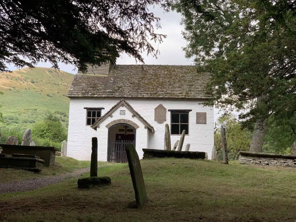
At the road, turn right and continue along to Capel-y-ffin. Turn left just after St Mary’s Church onto the gravel footpath, cross over the bridge and bear around to the right. Follow this tree-lined footpath as it contours the bottom of Hatterall ridge. After 1km, turn left to begin climbing the hill. Note there is a marked diversion around the Vision Farm, which replaces the old footpath.
This is where the second climb of the day begins. The steep path heads directly up the hill before easing out slightly into switchbacks amongst the ferns. At the 570m contour, the paths forks. Take the path to the left and continue along until you reach the ridge plateau.
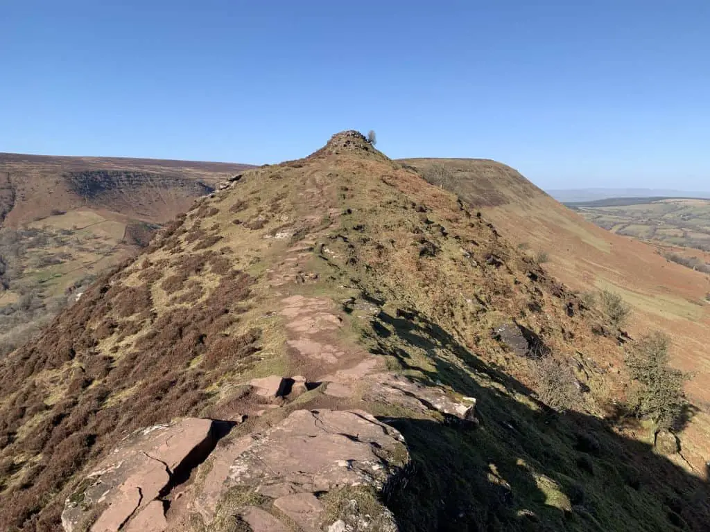
At this point you join Offa’s Dyke path which is runs along the length of Hatterall Ridge. Continue on this path in a northwest direction as it gradually climbs to the flat, broad summit of Black Mountain. The path continues to undulate before finally descending towards Hay Bluff.
At the crossroads marked by an Offa’s Dyke stone marker (acorn sign), ignore the paths to the right and continue along the path to the left. This flat sections continues all the way to Hay Bluff trig point. Enjoy the views from Hay Bluff, then take the path to the left to walk westwards towards Twmpa.
Descend from the western flank of Hay Bluff to Gospel Pass car park where you started this beautiful Hay Bluff walk.
3. The Vale of Ewyas Horseshoe
- Distance: 28 km (17.4 miles)
- Time: 8-9 hours
- Elevation Gain: 960m (3150ft)
- Starting Point: Llanthony Priory
- Difficulty: Strenuous
- Summits: Black Mountain, Hay Bluff, Twmpa, Rhos Dirion, Chwarel y Fan, Bal Mawr
This monster of a hike is the option to choose if you want to see it all. Along Hatterall Ridge you will enjoy views over the Herefordshire countryside and the Vale of Ewyas, and from Chwarel y Fan ridge you will enjoy views of popular Black Mountains peaks including Waun Fach, Sugar Loaf and Y Skirrid.
This walk begins at the beautiful Augustinian Priory of Llanthony. I provide a detailed description of this walk in my Llanthony Priory walks guide, however here is a brief overview.
From the priory, this walk joins the Loxidge Trail which links Llanthony to the Offa’s Dyke National Trail. This trail climb steeply up the hillside to join Hatterall Ridge. Once upon the ridge, the Offa’s Dyke path undulates to take in the featureless summit of the Black Mountain, before culminating at Hay Bluff which marks the abrupt end of the ridge.
From Hay Bluff the route heads southwest to descend to Gospel Pass before climbing once more to reach the summit of Twmpa and then Rhos Dirion. Here, the path turns southeast and begins the return journey. Along this ridge there are more summits to bag, including Chwarel y Fan and Bal Mawr.
Upon reaching the crossroads with the Beacons Way, the path then turns eastwards to descend back into Llanthony Valley. The steep descent is marked and signposted, leading back to the Priory where the long walk began.

4. Hay Bluff, Mynydd Du (Black Mountain) and Black Hill
- Distance: 16km (9.9 miles)
- Time: 5-7 hours
- Elevation Gain: 600m (1969ft)
- Starting Point: Hay Bluff Car Park (Grid Reference SO239373)
- Difficulty: Strenuous
- Summits: Hay Bluff, Black Mountain, Black Hill
After bagging the peaks of Hay Bluff and the Black Mountain, this walk crosses the border and ventures into England through the beautiful Olchon Valley and returns via the stunning Cat’s Back ridge OF Black Hill.
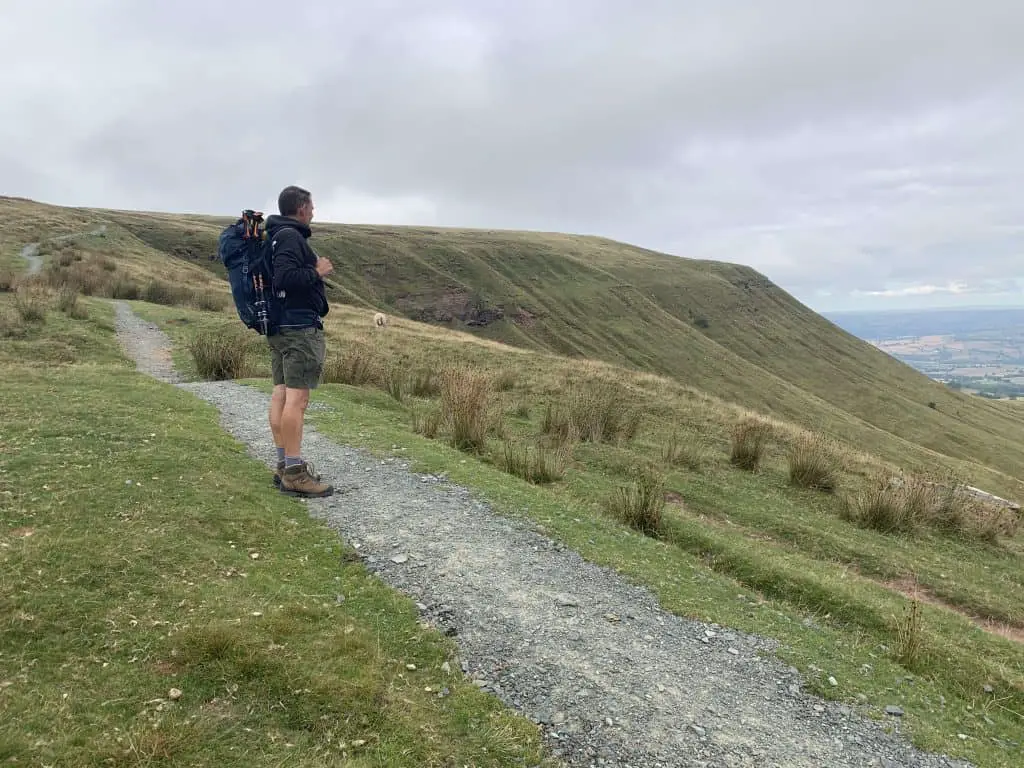
From the car park head towards the mountains and begin climbing the steep escarpment towards the summit of Hay Bluff. At the crossroads continue straight ahead for a steeper and more direct route to the summit. Alternatively bear right for a more gradual route and once atop the ridge turn left to walk to the summit trig point.
From Hay Bluff summit, take the path to the southeast to begin walking towards the next peak, the Black Mountain. Just before the plateau ends there is a crossroads with a stone marker denoting the Offa’s Dyke path. Continue along the well-maintained path to join the Offa’s Dyke path as it starts climbing the northern end of the Black Mountain.
The summit of the Black Mountain lacks any markers and is fairly long and flat so is easily missed. However, just after the summit there is a path that turns abruptly to the left and starts descending the eastern side of Hatterall Ridge. The path becomes more steep before reaching a T-junction. Turn right to begin the beautiful descent into the Olchon Valley.
The path here is obvious to follow as it descends through the valley, before passing through a gate to join a bridleway. Continue along the bridleway as it then turns into a tarmac lane. Follow the road to the fork and bear left to start climbing once again.
The road culminates at the Black Hill car park, which marks the return leg of this hike. From the car park, cross over the style and head northwest to begin the steep climb of Black Hill. This climb is quite challenging but is thankfully short lived and soon gives way to the stunning Cat’s Back ridge. This glorious ridge gradually makes it way towards Black Hill summit, offering superb views of the Black Mountains to the west and the Herefordshire countryside to the east.
After reaching the summit trig point, continue along the path as it crosses the boggy plateau. In good weather you will see Hay Bluff to the northwest as you continue to walk in this direction. The path contours the side of Black Mountain before reaching the Offa’s Dyke crossroads which you passed on the outward journey. From here, retrace your footsteps back to Hay Bluff and down to the car park beyond.
For more walks of Black Hill, see this guide.
Hay Bluff Walks – What do you need?
- Suitable clothing: warm layers and waterproofs
- Water, food, snacks: filtering water bottles are very handy for safely refilling in streams and rivers. You can read more about filtering water bottles in this guide. Psst! I’ve secured a deal for all readers of this website. Simply use the code WWG15 at checkout to get a 15% discount off all Water-to-go bottles and filters.
- Quality hiking boots or trail shoes are a must
- The relevant map and compass, and the ability to use them!
- A first aid kit for hiking
- GPS or mapping app:A great free app option is maps.me, although the free features have now become limited. I have an annual subscription to OS which means I have access to all UK OS maps on my mobile. I can definitely recommend it if you’re a regular hiker/walker.
These are just some of the essentials, but for a complete list of things to take on a hike in Wales, take a look at this guide!
Where to Stay in the Bannau Brycheiniog
The Bannau Brycheiniog/Brecon Beacons has several cute market towns and villages to use as a base for exploring the national park. There aren’t many large chain hotels but instead, you will find a selection of bed and breakfasts, pubs/Inns, glamping and camping opportunities.
As a central location, you can’t go far wrong with the town of Brecon. The beautiful Camden Lodge B&B offers exceptional service, with large, clean rooms that have delightful views over the hills. To experience the charm of a cosy, local pub try the Usk and Railway Inn at Sennybridge. This is a fabulous location for mountain bikers looking to get out in the hills.
If you’d prefer to be based near the Black Mountains in the east, opt for the The Bear which is an atmospheric old pub located in the small town of Crickhowell. In the west, Cwtch Bach is a gorgeous stone bricked holiday home perfect for exploring The Black Mountain region.
For luxury glamping ideas take a look at this guide to glamping in the Bannau Brycheiniog/Brecon Beacons.
Prefer not to walk alone? If you’re looking for a Mountain Leader to guide you on a mountain adventure, please contact me at [email protected] to discuss rates and availability.

Final Thoughts On Walking Hay Bluff
Hay Bluff is a peak in the Black Mountains of the Bannau Brycheiniog/Brecon Beacons. It is the northernmost point of Hatterall Ridge which provides a natural border between Wales and England. The steep sided escarpments of Hay Bluff allow for dramatic views over the lowlands below, providing hikers with a great opportunity for exploration. There are several walks that take in the summit of Hay Bluff, several of which I have outlined in this guide.
Join My Newsletter Today!