
Last Updated on 14/12/2025 by Louise
The Black Hill in Herefordshire is a peak at the eastern most edge of the Black Mountains. The Black Mountains are a range of mountains which mostly lie in the Bannau Brycheiniog (Brecon Beacons) of South Wales, with the exception of Black Hill. Black Hill is the only peak of the Black Mountains which lies fully in England.
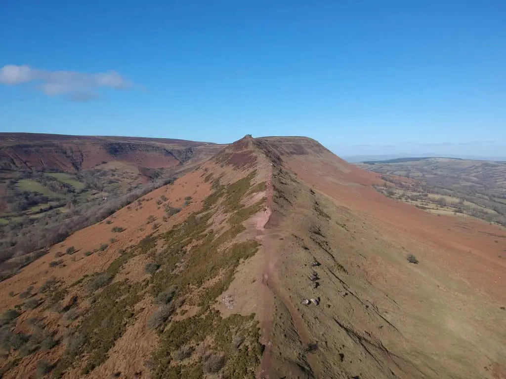
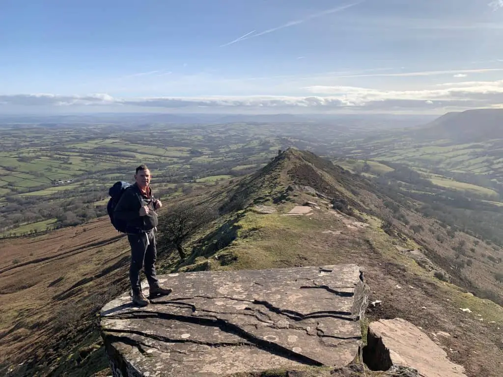
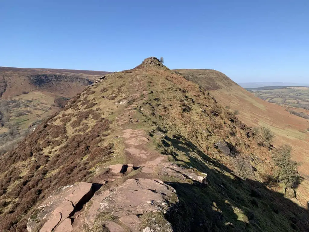
The Black Hill, whose summit sits at 640m in height, is famed for its ridge which runs the length of the mountain from north to south. The ridge is affectionately known as Cat’s Back since its shape resembles that of a cats arched back when viewed from the east.
There are several walking routes that take in the summit of Black Hill and the Cat’s Back ridge. The classic Black Hill walk involves ascending Cat’s Back ridge to the summit before descending via Olchon Valley. This loop is 5 miles long and takes around 3 hours to complete.
In this guide, I describe three Black Hill walking routes which vary in length and difficulty. I provide distances, times, starting locations and a video of the most popular walk.
Disclaimer: Some links in this article are affiliate links, which means that if you purchase through them I receive a small commission, at no extra cost to you. This helps cover the cost of running this blog. Thanks for your support!
Black Hill and The Cat’s Back Ridge Walks
Sitting at just 640m, Black Hill doesn’t rank that highly compared to some of the higher peaks in the neighbouring Brecon Beacons, but it’s a mountain that shouldn’t be underestimated. The initial climb of Black Hill from the south is fairly steep and is certain to get the heart beating fast.
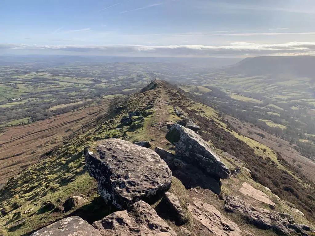
All of the walks described below include an ascent of the Cat’s Back ridge. As is often the way, ascending the ridge provides the best views of the surrounding landscape, although don’t forget to look back every now and again to appreciate the views behind.
The Cat’s Back ridge is quite narrow with drop-offs on either side. Those with a fear of heights might feel a little weary in places but it doesn’t compare in exposure to ridges such as Crib Goch in Snowdonia or Striding Edge in the Lake District. The footpath is several meters wide along the whole length of the ridge.
Black Hill Walking Loop Video
Prefer to watch rather than read? No worries, here’s a short video showing the classic Black Hill and Cat’s Back circular walk.
1. Black Hill via The Cat’s Back Ridge Loop
- Distance: 7.9km
- Time: 2.5 – 3 hours
- Elevation gain: 301m
- Difficulty: Moderate
- Starting Point: Black Hill car park
- Map: OS Explorer OL13 Brecon Beacons National Park
This is the shortest loop and most popular walk of Black Hill. On this walk you can enjoy far-reaching views over the Herefordshire countryside along the ascent of Cat’s Back ridge and breath-taking views of the Olchon Valley on the descent.
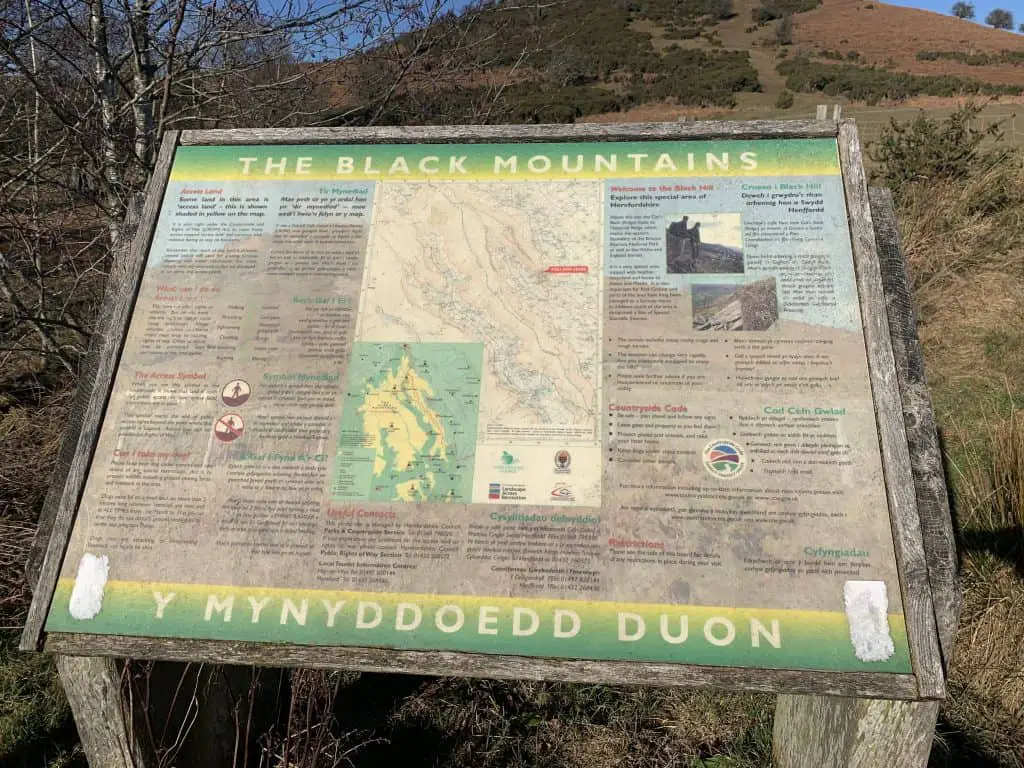
The starting location for this hike is the Black Hill car park which you can find on Google Maps here. At the car park you can find a notice board which provides information on the Black Mountains. Cross over the style, which is located to the right of the notice board and begin climbing the hill directly in front.
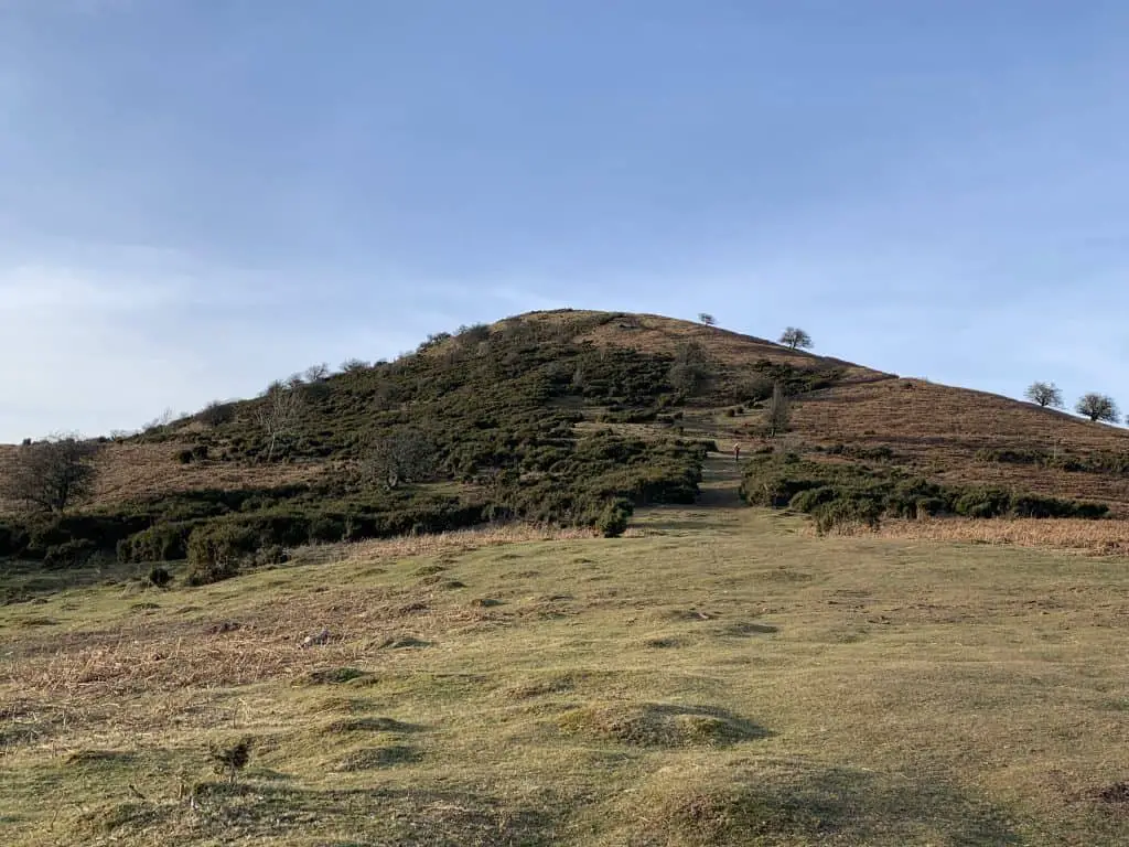
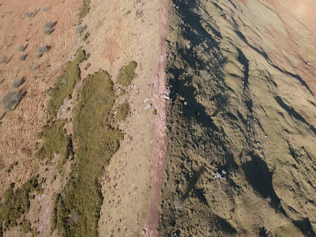
The path leads directly up the hill which is steep and fairly hard going until you reach the ridge. Some side spurs lead to the left of the ridge but stay true to the path stay atop the ridge and get the best of the views. Once on top of the southern end of the Cat’s Back there is a gradual ascent to the summit of Black Hill.
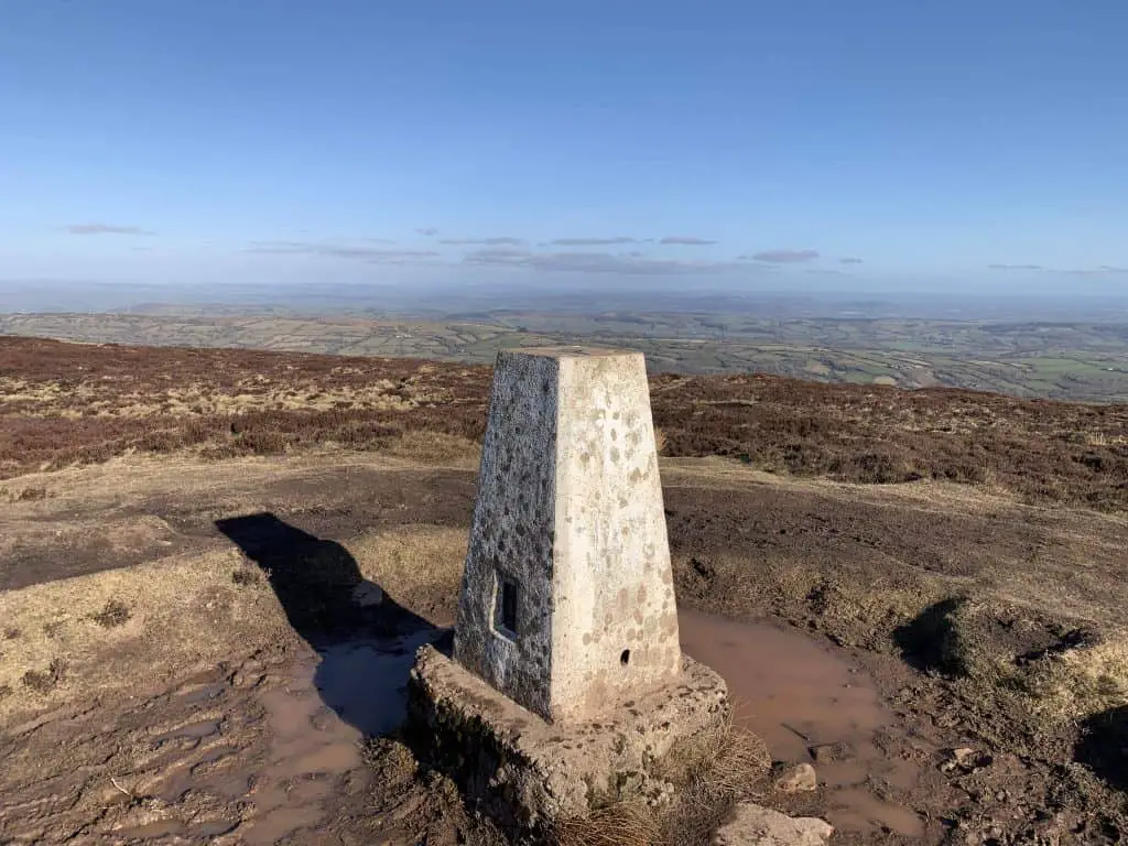
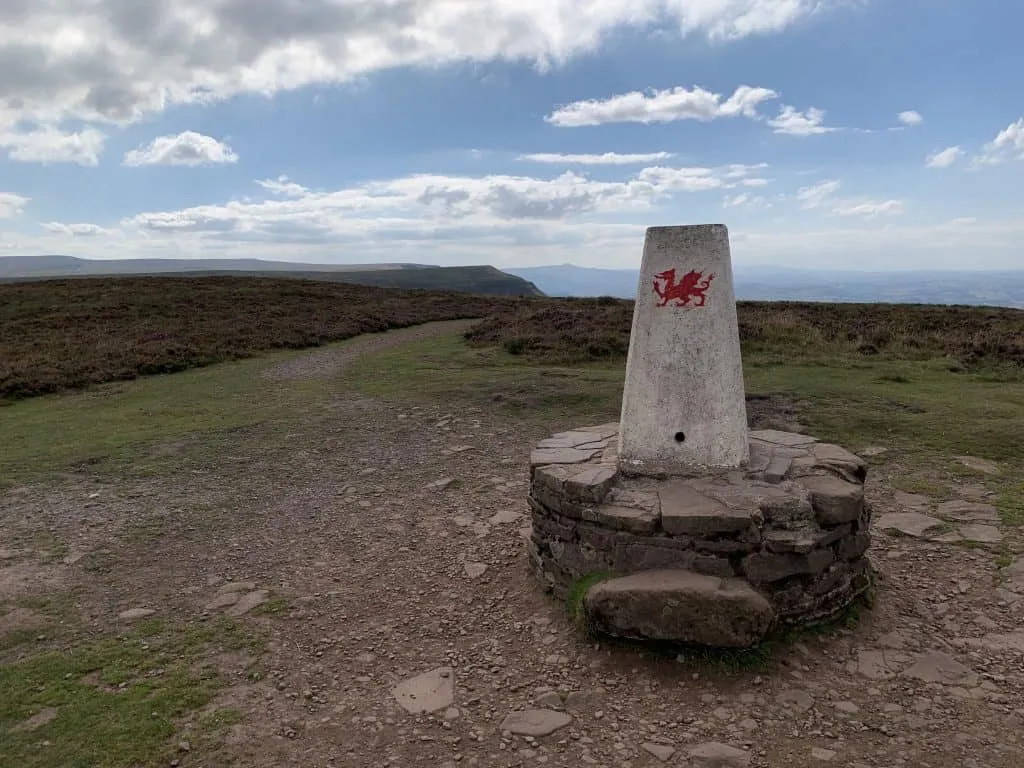
Enjoy views over the Herefordshire countryside to the east and Hatterall ridge and the Black Mountains to the west. Hatterall Ridge marks the natural border between England and Wales. The summit of Black Hill is marked is marked by a trig point and provides pleasant views in all directions but nothing as spectacular as those on offer along the ridge.
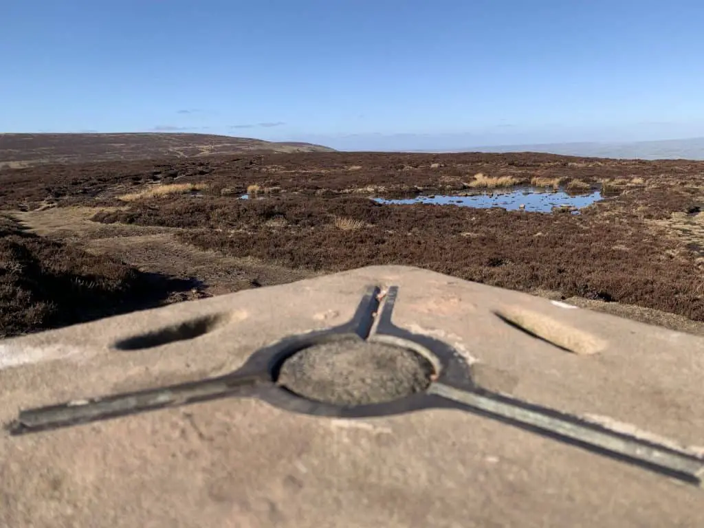
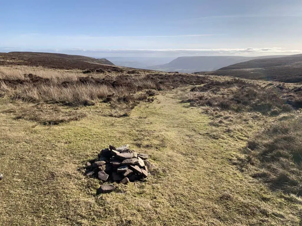
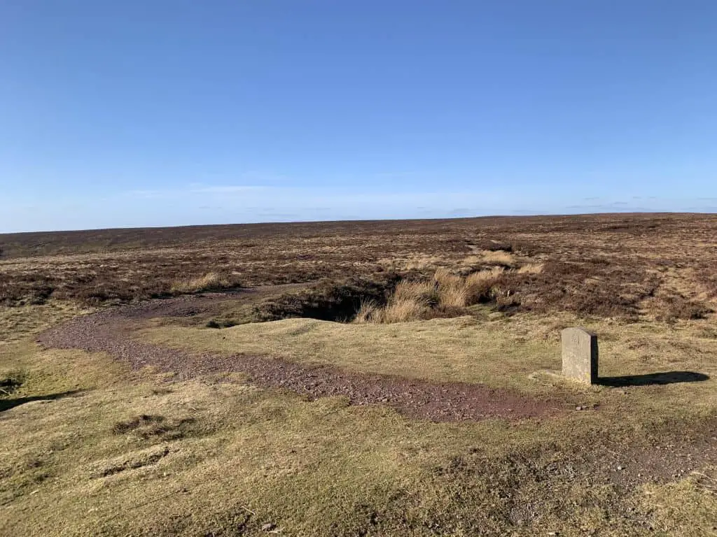
Leave the summit along the path to the left as it continues in a northwesterly direction. This summit plateau is a peat bog and can be very wet in winter. Walk along this path for around 3km, at which point you will meet a crossroads in the trail, marked by a small rock pile.
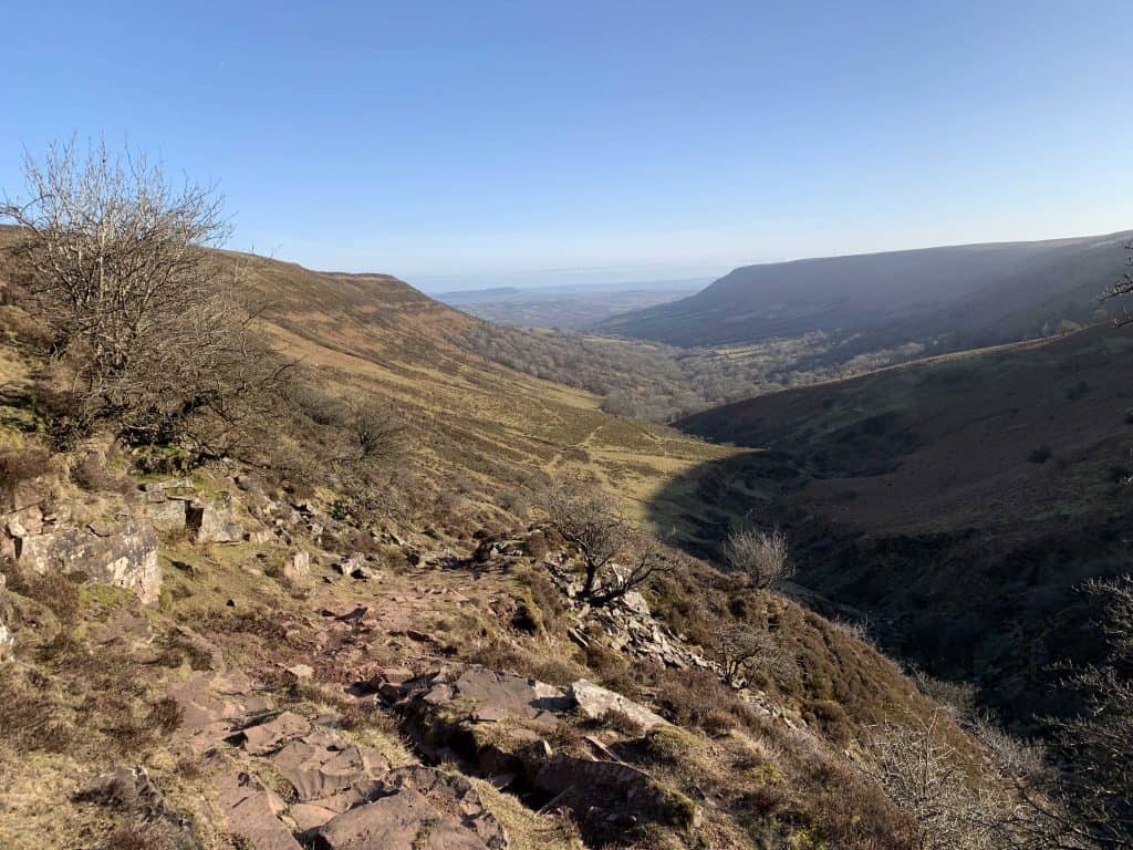
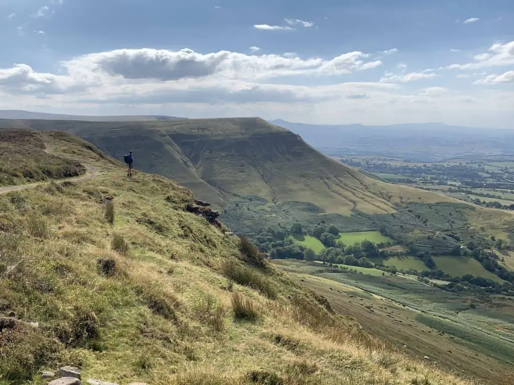
Turn left here to almost walk back on yourself and begin the descent into Olchon Valley. As you follow this path the views start to open up and you’re in for the second treat of the day! The dramatic Olchon Valley is flanked by Hatterall ridge on the west and Cat’s Back ridge on the east and provides a breathtaking return leg.
As the path levels out, cross through a wooden gate and begin walking along the bridleway. Shortly after, this bridleway becomes a tarmac lane which leads the rest of the way down the valley. When the road forks, branch left following the brown sign picnic sign to climb the last stretch back to the car park where you started.
Map of Back Hill Circular Walk
Below is a map of this walk marked out on AllTrails.
2. Black Hill, Hay Bluff and Black Mountain Loop
- Distance: 13km
- Time: 4-5 hours
- Elevation gain: 400m
- Difficulty: Moderate
- Starting Point: Black Hill car park
- Map: OS Explorer OL13 Brecon Beacons National Park
This walk summits Black Hill along with Hay Bluff and Mynydd Du (Black Mountain) which are two peaks in the Bannau Brycheiniog/Brecon Beacons. The loop includes fabulous views from along two ridges – Cat’s Back ridge and Hatterall ridge.
From the Black Hill car park, cross over the style at the far end of the car park and begin climbing the hill directly in front of you. Head directly up the hill and make your way onto the narrow ridge of the Cat’s Back. Continue along the ridge as it gradually makes it way to Black Hill peak.
From the summit trig point, follow the path as it continues in a northwesterly direction. As you walk you will see Hay Bluff mountain which marks the northern most end of the Bannau Brycheiniog/Brecon Beacons. The path gradually descends into a saddle between Black Hill and the Black Mountain.
At the small rock pile, take the path to the right to contour around the side of Black Mountain and gradually climb towards the ridge plateau. Upon reaching the plateau you will see a crossroads with stone marker which has an acorn symbol carved into it. This is the symbol of the Offa’s Dyke path, which is a long distance hiking trail that runs the length of the Welsh/English border.
At the crossroads continue straight ahead on the well maintained path, ignoring the paths to the left and right. As soon as you pass this stone marker you have officially crossed into Wales. Croeso! If the weather is clear, from here you will see Hay Bluff trig point.
Follow the path along the plateau which leads straight to Hay Bluff. From the summit cairn there are dramatic views looking northwards to the Wye Valley and westwards along the northern edge of the Beacons.
After you’ve finished admiring the views, turn around and walk back to the crossroads, but this time take the path to the right. This well maintained gravel path is Offa’s Dyke. Very shortly the path begins to climb towards the third peak of the day. As you walk along this broad ridge known as Hatterall ridge, you can appreciate distant views over the Bannau Brycheiniog/Brecon Beacons although its width prevents any meaningful views over the Ewyas Valley of Llanthony Priory fame.
After around 1.2km you will reach the Black Mountain (or Mynydd Du in Welsh), which is a flat summit with no trig point. Just after the summit turn sharply left to follow the path leads downhill in the direction of Black Hill. As you descend you can see the whole of Black Hill and the Cat’s Back directly ahead.
Soon this path drops steeply into the valley below. Turn right at the T-junction to join the rocky trail that descends into the beautiful Olchon Valley. Follow the path for 3.5km as it first becomes a bridleway and then a small country lane. When the road forks, take the lane to the left as it leads back to the car park at the start of the loop.
More Walks In The Black Mountains
- Walks of the Blorenge
- The best routes to the summit of Sugar Loaf
- How to hike Skirrid Mountain
- Hiking Waun Fach and the Dragon’s Back
3. Black Hill and Hay Bluff Circular From Craswall
- Distance: 15km
- Time: 5 hours
- Elevation gain: 636m
- Difficulty: Strenuous
- Starting Point: Bull’s Head, Craswall
- Map: OS Explorer OL13 Brecon Beacons National Park
This circular walk climbs Cat’s Back to Black Hill peak before making the gradual climb to Hay Bluff to enjoy views over the Bannau Brycheiniog/Brecon Beacons. The starting location is better suited to those travelling from the north.
Just to the east (left) of the pub there is a sunken lane that climbs uphill and into the fields. At the crossroads on the 350m contour line, turn left to follow the path as it traverses around the base of the hill. The path can be wet and muddy as it crosses over several streams and take the higher path at any forks.
At the southern most end of the hill, just before arriving at Black Hill car park, turn right to begin climbing Black Hill. The climb is steep at first before it levels off onto Cat’s Back ridge. Continue along this narrow ridge as it gradually leads uphill to Black Hill summit.
From the summit trig point, continue along the muddy path as it heads towards the Black Mountain range. The path descends slightly as it reaches the saddle between Black Hill and the Black Mountain. At the path crossroads, marked by a small rock cairn, continue straight ahead along a path which contours Black Mountain. This path gradually climbs to meet a plateau on Hatterall ridge.
This time the path junction is marked by a stone marker inscribed with an acorn. This denotes the Offa’s Dyke path. Ignore the paths to the left and right and continue straight ahead and the well maintained gravel path. This flat section of trail leads all the way to the end of the ridge and the summit trig point of Hay Bluff.
Hay Bluff provides glorious views over the Wye Valley below and the northern end of the Beacons mountains to the west. From the trig point head north to begin descending the escarpment. The path zig-zags left, then right to make its way down the hill.
Keep heading north, ignoring the path that branches off to the left towards Hay Bluff car park. At the 510m contour you will reach another crossroads in the path. Turn right to start walking in a westerly direction. The descent starts to flatten off as you begin to traverse once again around the base of Black Hill.
This section can again be wet and muddy as streams flow off the hill to feed the river Monnow. Continue along the footpath until you reach the first junction of this walk. Turn left here to return back to the Bull’s Head.
For more routes to the summit of Hay Bluff, see this guide.
Map of Black Hill and Hay Bluff Circular Walk
This walk is marked out on AllTrails.
Black Hill Walks – What do you need?
- Waterproof Jacket – the weather can change quickly in the mountains so it’s best to be prepared. And Trousers.
- Food & Water – bottles with filters are very handy for safely refilling in streams and rivers. Discover which filtered water bottle is right for you in this handy guide!
- Hat, gloves and warm layers for the summits (yes even in Summer!)
- Good hiking boots in winter or hiking trainers in summer
- A First Aid Kit for trekking
- These routes are marked on the maps.me app, so consider downloading the map before you go. Alternatively, you can get an annual subscription with OS which provides digital access to all UK OS maps, including planned routes. Check it out here.
- The OS Explorer OL13 Brecon Beacons National Park map and compass.
For a complete mountain day packing list, take a look at this article.
Black Hill Walks Summary
The Black Hill is a mountain in Herefordshire in the Black Mountains range. Standing at 640m in height, it sits just outside the Bannau Brycheiniog/Brecon Beacons National Park. The Black Hill is also known as the Cat’s Back due to the arched ridge that runs along its length.
There are multiple walks of Black Hill which can include venturing into neighbouring Wales to bag summits in the Bannau Brycheiniog/Brecon Beacons. The classic Black Hill walk involves ascending Cat’s Back ridge to the summit before descending via Olchon Valley. This loop is 5 miles long and takes around 3 hours to complete.
Join My Newsletter Today!