
Last Updated on 15/12/2025 by Louise
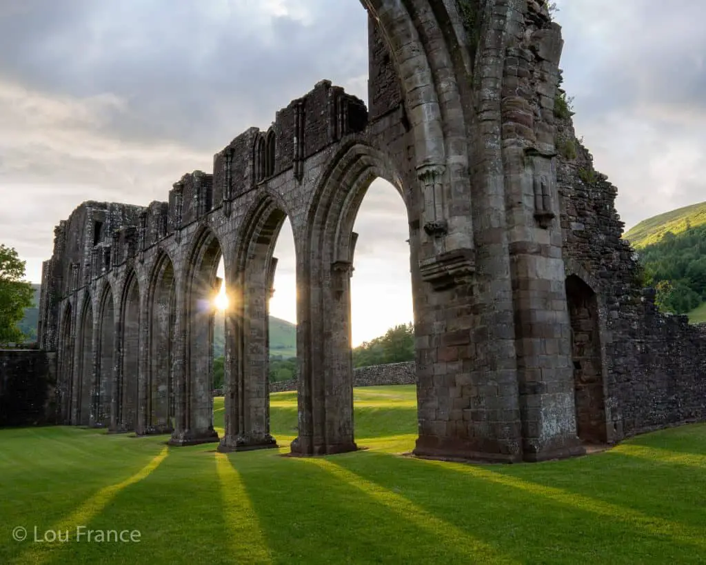
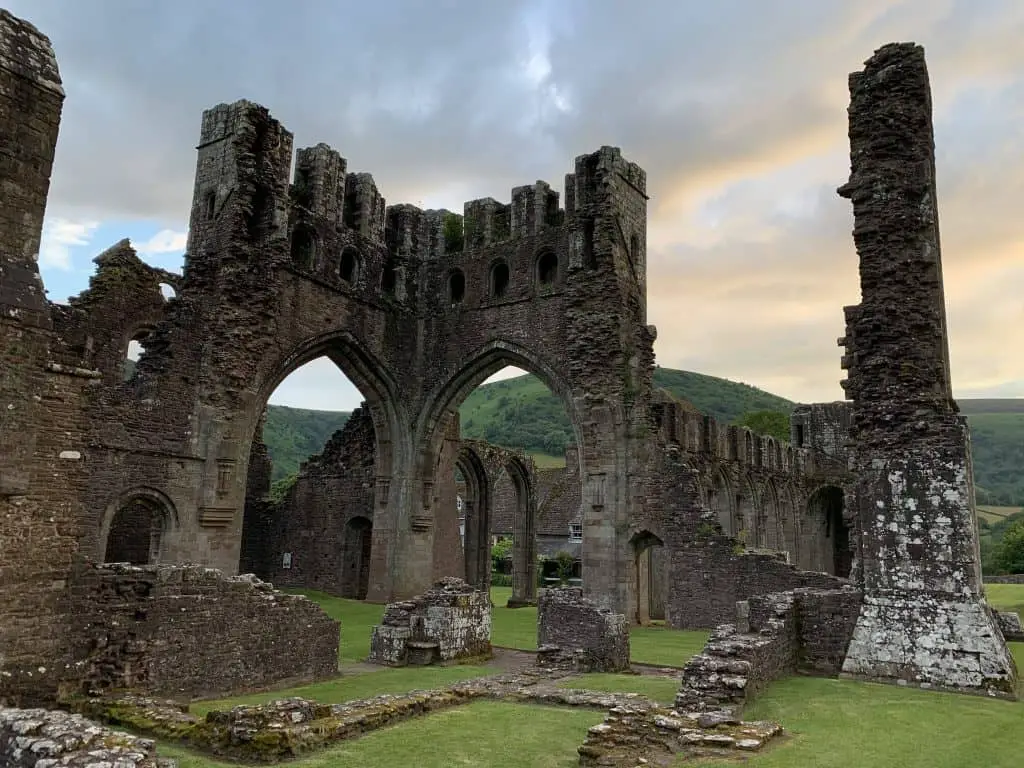
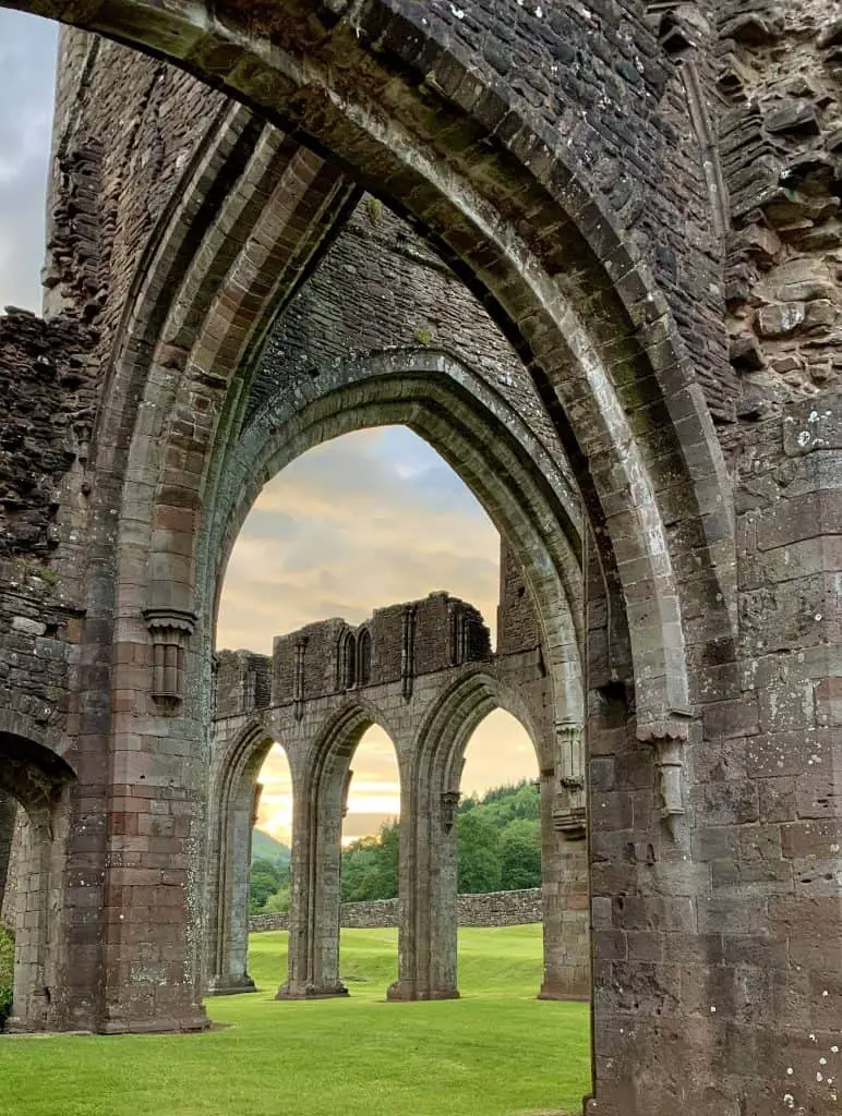
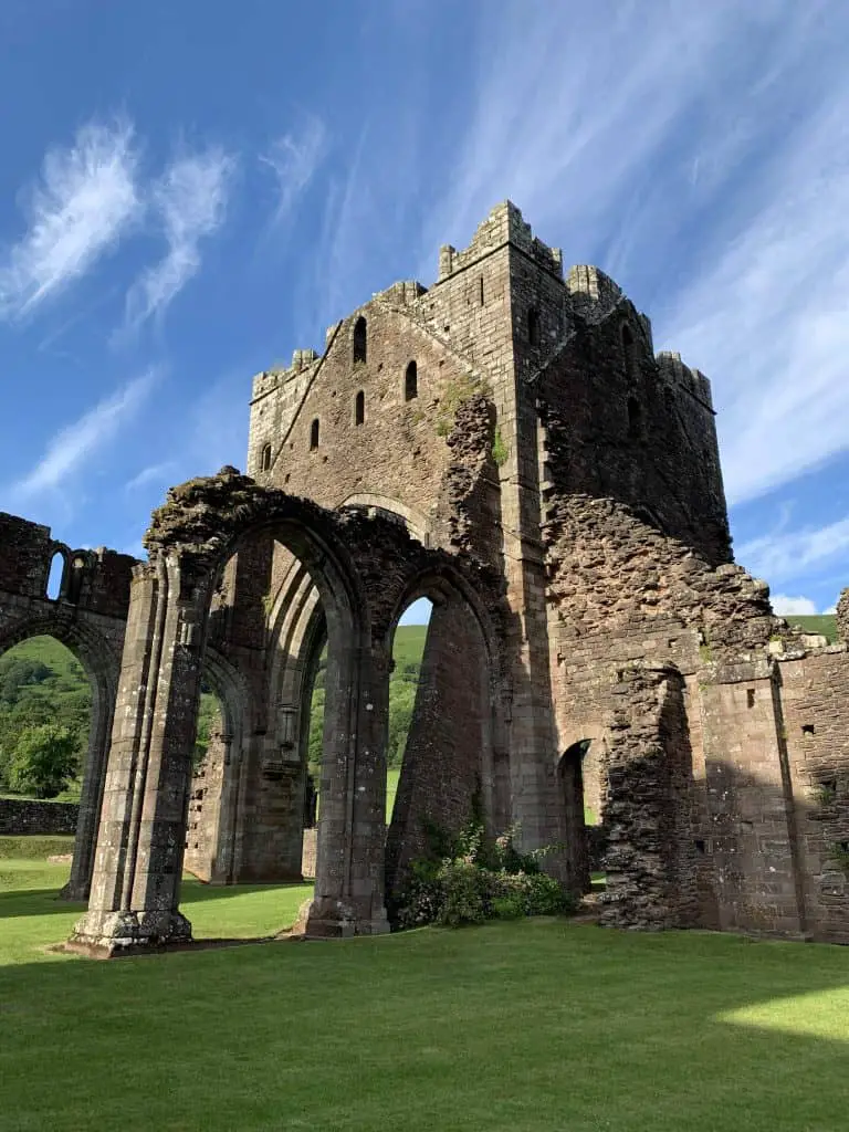
Llanthony Priory is an early 12 century Augustinian Priory in South Wales. The priory is partly in ruin and is a grade 1 listed building. Llanthony is located in the Vale of Ewyas which is an impressive glaciated valley in the Black Mountains region of the Brecon Beacons (Bannau Brycheiniog).
To the east of the priory lies Hatterall Ridge and to the west the long ridge that separates the Gwyrne Fawr Valley. The remote location for this iconic landmark ensures walks around Llanthony Priory are both beautiful and challenging.
This is a complete guide to hikes around Llanthony Priory and the Vale of Ewyas.
Disclaimer: Some links in this article are affiliate links, which means that if you purchase through them I receive a small commission, at no extra cost to you. This helps cover the cost of running this blog. Thanks for your support!
1. Llanthony Priory Circular Short Walk
- Distance: 8.2 km
- Time: 3-4 hours
- Elevation Gain: 463m
- Starting Point: Llanthony Priory
- Difficulty: Moderate
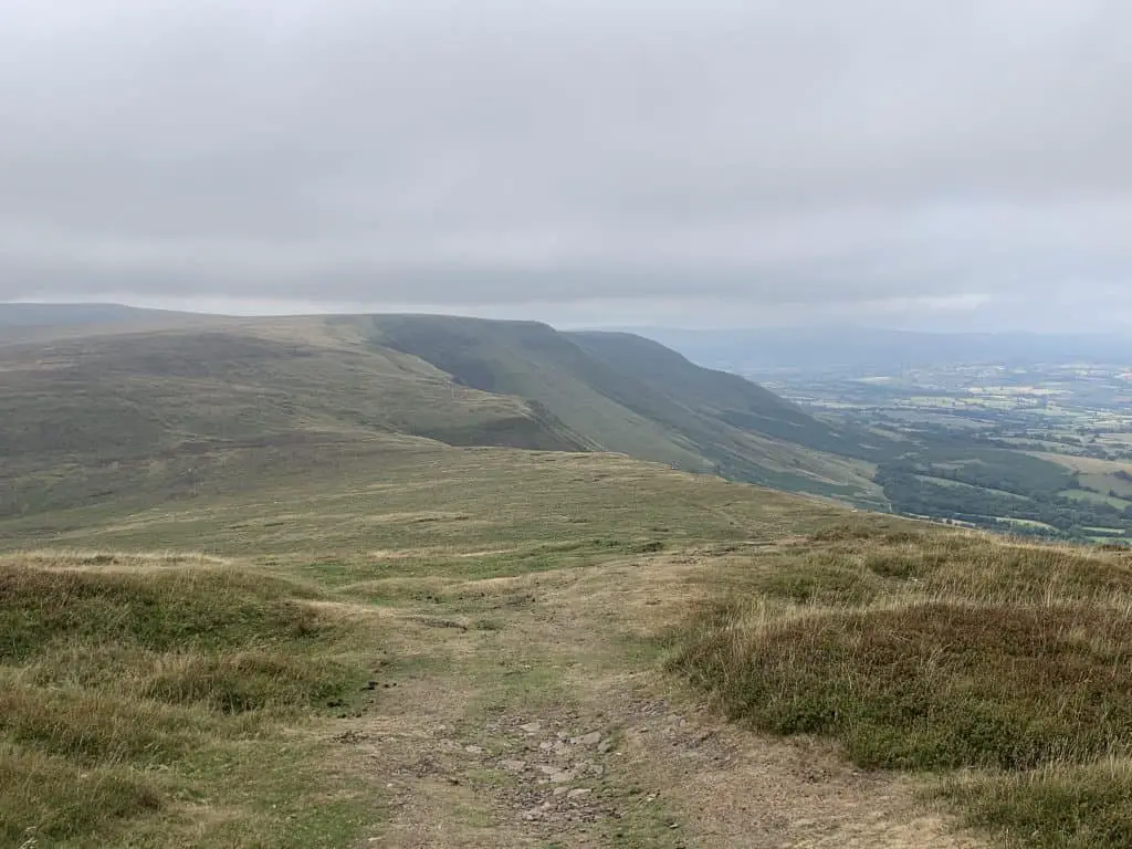
This is a short walk that takes in Hatterall Ridge and walks a section of Offa’s Dyke National Trail. From the ridge, views stretch over the English countryside to the east, the Welsh mountains to the west and Llanthony Priory down below.
For this walk, head east out of the priory in the direction of Wirral Woods and follow the signs for the Beacons Way towards Hatterall Hill. It’s a steep climb up the hill to get onto the ridge, which is marked by a stone cairn. Once on the ridge turn left onto the Offas’s Dyke path which is a well-marked long-distance hiking path that runs the length of Wales.
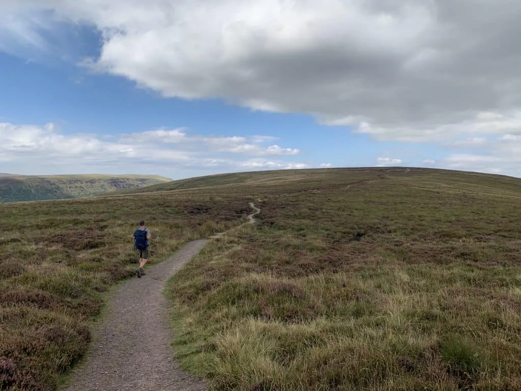
Continue along Hatterall Ridge for just under 2 miles until you reach a stone marker at elevation 605m. Enjoy views of Black Hill and the Olchon Valley on the right and the Ewyas valley on the left. This is the turning point (left turn) to follow the Loxidge trail which descends back into the valley in a southwesterly direction.
The hill descends gradually at first before becoming much steeper to drop into the valley. Once off the ridge continue along the path, crossing the fields and a series of styles, following signposts for the priory where you started.
If you’re enjoying this content, please consider giving me a follow on social media
2. The Vale of Ewyas Horseshoe
- Distance: 28 km
- Time: 8-9 hours
- Elevation Gain: 960m
- Starting Point: Llanthony Priory
- Difficulty: Strenuous
This is a great full day in the mountains that covers a lot of distance, and it is this, rather than the amount of climbing involved that makes this hike strenuous. From the car park, head in a westerly direction towards the farm, past the priory, through the gate and turn right. This is the Loxidge Trail which connects Llanthony to Offa’s Dyke.
Follow the path through the fields, following signposts which direct you towards Hatterall Ridge. Cross of a series of styles before the hill starts to steepen. This is the first and biggest climb of the day. Soon however, the slog is over and the climb eases off to reach the broad ridge.
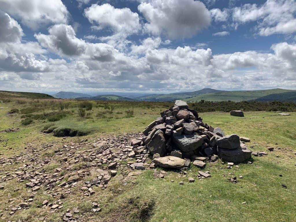
At the summit the path meets Offa’s Dyke footpath which is marked by a stone cairn. Turn left here to begin the long traverse along Hatterall Ridge. The ridge climbs gradually to its highest point called the Black Mountain at 703m, before dropping down towards Hay Bluff.
Here, ignore the right turn of Offa’s Dyke and instead continue straight ahead towards the peak of Hay Bluff at 677m. Enjoy the dramatic views here as you reach the northerly end of the Bannau Brycheiniog/Brecon Beacons range and the Wye Valley opens up beneath. At the Hay Bluff trig point, turn left to walk along the top of the escarpment before descending to Gospel Pass.
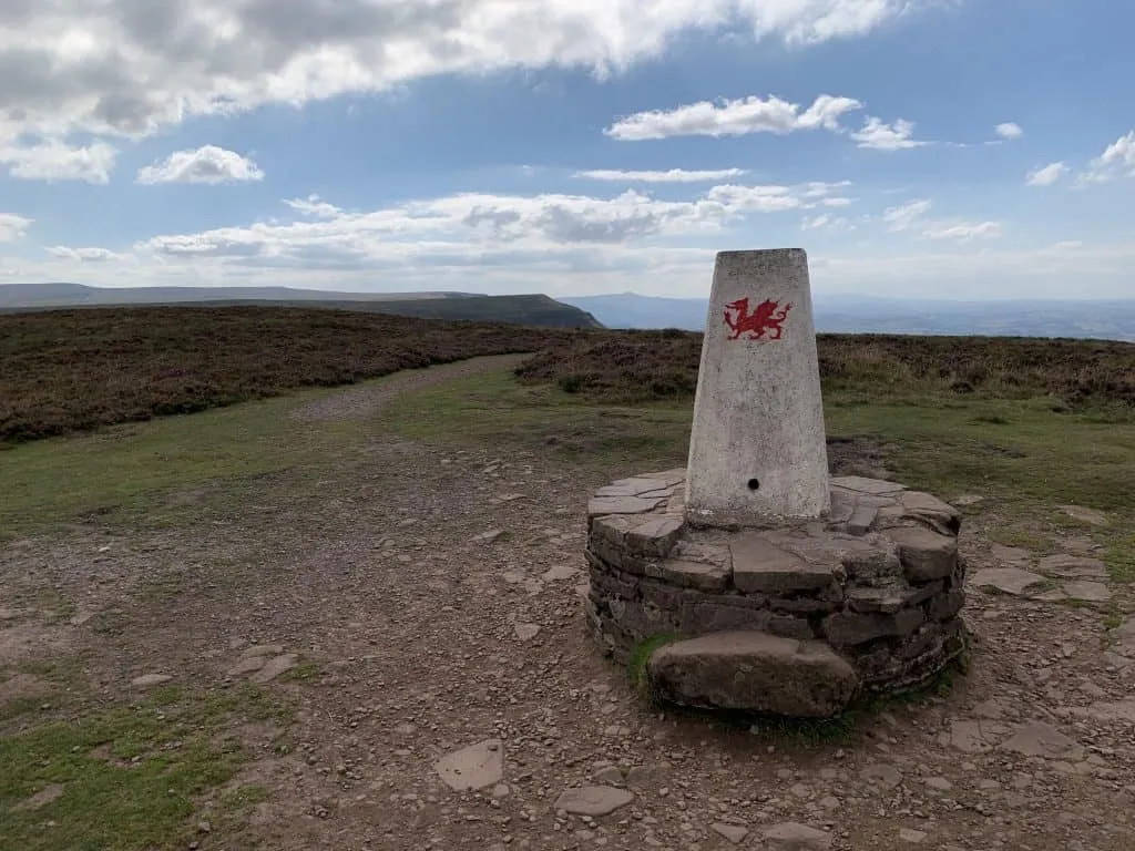

Cross over the road and begin the climb up towards Twmpa (Lord Hereford’s Knob). This is the second climb of the day but this is nowhere near as big as the first. Again the path is well established and before too long you will be at the summit which is marked by a stone cairn.
From the cairn, continue straight ahead in a southwesterly direction as it drops down into the saddle, before climbing gently to the next peak of Rhos Dirion (713m). This marks the furthest away part of this epic hike and the start of the return leg. On clear days views will stretch as far as Pen y Fan in the Central Beacons.

From the summit turn left to begin walking along the broad ridge. This section gently undulates between the peaks, then at Chwarel y Fan the ridge becomes more narrow allowing far reaching views to open up once more. You can appreciate views into Grwyne Fawr Valley to the west and the Grwyne Fawr Reservoir to the northwest.
Continue along to Bal Mawr (607m) peak before beginning the descent back towards Llanthony Valley. At the crossroads with the Beacons Way, marked with a stone marker, turn left and leave the ridge behind you. Shortly after, turn right to drop into Cwm Bwchel and follow the stream into the valley.
The path is initially steep and there are several gates and signposts that lead the way back towards the priory. Once you arrive in Llanthony, turn left to cross over the Afon Honddu (river), past the campsite and onto the road that takes you back to the priory.
Pull up a pew and enjoy a well earned beer at the Priory cellar bar!
Now Available
Bannau Brycheiniog Hiking Routes
Hiking routes include the ever popular Pen y Fan, Llyn y Fan Fach, Sugar Loaf and the Four Falls.
Enjoy 35 beautiful hikes in Bannau Brycheiniog (the Brecon Beacons) with the help of my pre-planned hiking routes. I have 35 beautiful hiking trails marked out on the free, offline app Maps.me. Simply download my pins into the app and choose which one of these epic hikes you’d like to enjoy!
3. Chwarel y Fan Ridge Loop
- Distance: 14.5 km
- Time: 4-6 hours
- Elevation Gain: 430m
- Starting Point: Llanthony Priory
- Difficulty: Strenuous
This Llanthony loop walk takes in the ridge on the western side of the valley, offering fantastic views of the Black mountains and the Vale of Ewyas also known as Llanthony Valley. From the car park head back past the priory and through the wooden gate into the adjacent field. Continue straight ahead, rather than taking the signposted trail to the right.
Walk past the gatehouse building and onto the road. Continue along the road past the Half Moon Inn and where the road forks, bear right. Continue along this quiet country lane for around 1km where the road becomes a dirt track. Continue straight ahead as the footpath follows the valley floor.
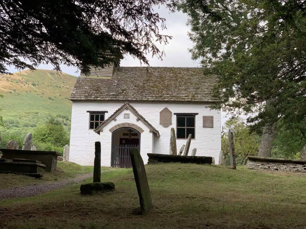
Once again the footpath becomes a road before switching back to a footpath at the Vision Farm. Continue along this path until you reach Capel-y-ffin. Pass the small church and turn left onto Gospel Pass Road. Cross over the bridge and turn immediately right, following this road for just under 400m.
At the Grange trekking centre and campsite, turn left to access the footpath onto the hillside. Once on the footpath, the ascent of the ridge begins. Follow the path as it climbs the mountain via a series of switchbacks. Towards the top, the climb flattens out until the path meets a crossroads marked with an anvil stone.
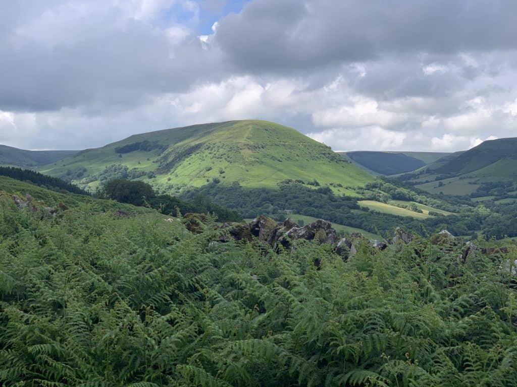
Turn left at the crossroads to walk along the ridge in a southeasterly direction. On your right, enjoy views of the Gwyrne Fawr Valley and the large flat top peak of Waun Fach, the highest peak in the Black Mountains. Further along there are trig points to mark the ridge summits of Chwarel y Fan and Bal Mar.
After Bal Mawr, the descent begins gradually until you reach the crossroads which meets with the Beacons Way, marked with a rock cairn. Turn left here to start the steep decent into Cwm Bwchel, branching to the right at the fork.
The path is initially steep and there are several gates and signposts that lead the way back towards the priory. Once you arrive in Llanthony, turn left to cross over the Afon Honddu (river), past the campsite and onto the road that takes you back to the priory.
Related Reading
- The best hikes in the Brecon Beacons
- Waterfall walks in the Brecon Beacons
- Things to do in the Brecon Beacons
How To Get To Llanthony Priory
The attraction of Llanthony Abbey is its remote location, however this makes getting there pretty impossible unless you have a car. No buses service this area and the nearest train station is Abergavenny which is 6 miles away.
To access Llanthony via car, use NP77NN in your GPS. Be warned you may have no phone signal when you arrive, it’s a bit of a signal black hole, so be sure to have an offline map available. (I use the free app maps.me which works great)
Llanthony Priory Walks – What do you need?
- Suitable clothing: warm layers and waterproofs
- Water, food, snacks: filtering water bottles are very handy for safely refilling in streams and rivers. You can read more about filtering water bottles in this guide. Psst! I’ve secured a deal for all readers of this website. Simply use the code WWG15 at checkout to get a 15% discount off all Water-to-go bottles and filters.
- Quality hiking boots or trail shoes are a must
- The relevant map and compass, and the ability to use them!
- A first aid kit for hiking
- GPS or mapping app: A great free app option is maps.me, although the free features have now become limited. I have an annual subscription to OS which means I have access to all UK OS maps on my mobile. I can definitely recommend it if you’re a regular hiker/walker.
These are just some of the essentials, but for a complete list of things to take on a hike in Wales, take a look at this guide!
Prefer not to walk alone? If you’re looking for a Mountain Leader to guide you on a mountain adventure, please contact me at [email protected] to discuss rates and availability.
Llanthony Priory Hotel and Campsite
If you want rest and recuperate after you hike, then why not stay at the priory itself? The rooms are designed to be a place where you can escape the hustle and bustle of the digital world, as there are no TVs or phone signal here.
All that’s left to do is soak in the atmosphere of the beautiful surroundings and perhaps enjoy a meal and a real Welsh ale in the cellar bar, complete with open log fire.
Llanthony Priory Hotel
Llanthony
Abergavenny
Monmouthshire
NP7 7NN
Tel: 01873890487
If you’d prefer to camp then just a stone’s throw from the Priory you can pitch your tent at Llanthony Court Camping. The facilities are basic with just a tap for water and toilets located in the car park but the location is everything. And since Llanthony is one of the best areas in the Brecon Beacons for Dark Skies, just sit back and enjoy the night sky. No bookings are necessary and the cost is £5 per person.

If you’re happy to stay outside the valley try The Celyn B&B which is a lovely farmhouse set in a 400 acre family farm not too far from Llantony.
Final Thoughts on Llanthony Priory Circular Walks
Llanthony Priory is medieval Augustinian Priory located in the Black Mountains of the Bannau Brycheiniog/Brecon Beacons. The setting for this ruin provides an amazing starting location for some fabulous mountain walks. In this guide I describe 3 Llanthony Priory circular walks for varying abilities. For each walk I provide a trail description, distances and approximate times.
Join My Newsletter Today!