The Nantlle Ridge is a range of mountains on the west side of Eryri (Snowdonia) National Park. This stretch of mountains includes severn peaks ranging between 600 meters and 800 meters in height. Although walks of this area often involve skipping peaks and forming a loop, a traverse of the full range is not to be missed.
The Nantlle Ridge traverse is a fabulous full-day walk in Eryri where you’re sure to escape the crowds and experience a true sense of remoteness. Although this ridge is nowhere near as technical as the Snowdon Horseshoe nor as long as a traverse of the Carneddau, it offers incredible views throughout and is edgy enough to provide that true ridge feeling.
Embarking on a hiking adventure along the Nantlle Ridge is an experience that will leave an indelible mark on your soul. With its awe-inspiring beauty, challenging terrain, and panoramic vistas, this hidden gem of North Wales offers a journey unlike any other.
Read on to discover my complete guide to the Nantlle Ridge traverse from Rhyd Ddu to Nebo.

Disclaimer: Some links in this article are affiliate links, which means that if you purchase through them I receive a small commission, at no extra cost to you. Thank you! This helps cover the cost of running this blog and keep all resources free to access 🙂
Nantlle Ridge Quick Stats
- Distance: 14.5 km (9 miles)
- Difficulty: Hard
- Duration: 5-8 hours
- Elevation Gain: 1077.5m (3535ft)
- Map: OS Explorer OL17
- Starting location: Rydd Ddu car park
- Finish location: Nebo (Near Llyn Cwm Dulyn)
- Weather Forecast: Met Office
- How to pronounce: Nant -thle
- Peaks Summited: Y Garn (633m), Mynydd Drws-y-Coed (695m), Trum Y Ddysgl (709m), Mynydd Tal-y-Mignedd (653m), Craig Cwm Silyn (734m), Garnedd-goch (700m), Mynydd Craig Goch (608m)
Nantlle Ridge Map

Click here to open the route in OS maps
Logistics of a Nantlle Traverse
The biggest drawback of doing this hike is the logistics involved. Since it is a one way walk you will either need two cars or the use of public transport to navigate between the start and finish points.
If using two cars, the best parking is on Cwm Dulyn road, near Llyn Cwm Dulyn (lake) rather than in Nebo itself where there is limited parking. There are no facilities in Nebo.
In Rhyd Ddu there is the Rhyd Ddu car park which is pay and display and has toilet facilities. Alternatively, there is a layby on the B4418 road with space for a handful of cars and is free to use.
If using public transport, the easiest option is to take the Snowdon Sherpa to the starting point in Rhyd Ddu and then call a taxi to return from Nebo to Rhyd Ddu.
Route Overview
My recommended route to conquer the Nantlle Ridge starts at Rhyd Ddu, a picturesque village nestled at the foot of the mountains and more commonly known as a starting location for a hike of Yr Wyddfa. From there, you embark on a journey that spans 14.5 kilometres, encompassing a series of peaks, ridges, and breathtaking viewpoints.
Be prepared for a difficult trek, as walking the entire ridge requires a good level of fitness. Although the mountains in this range are small in comparison to other peaks in Eryri, there is still a lot of elevation gain and a fair distance to cover. There is also a short grade 1 scramble of Mynydd Drws-y-Coed, which calls for an element of hiking experience along with a head for heights.
This is a trail description for the Nantlle Ridge walking from east to west. It’s also possible to complete this walk from west to east. For those interested in bagging peaks, this trail includes 7 mountains which are all classified as Nuttalls, and 5 of which are Hewitts (Y Garn, Mynydd Drws-Coed, Trum y Ddygyl, Mynydd Tal-y-Mignedd, Craig Cwm Silyn, Mynydd Craig Goch).
Learn more about Hewitts, Nuttalls and the highest mountains of Wales in this guide.
Nantlle Ridge Hiking Route Description
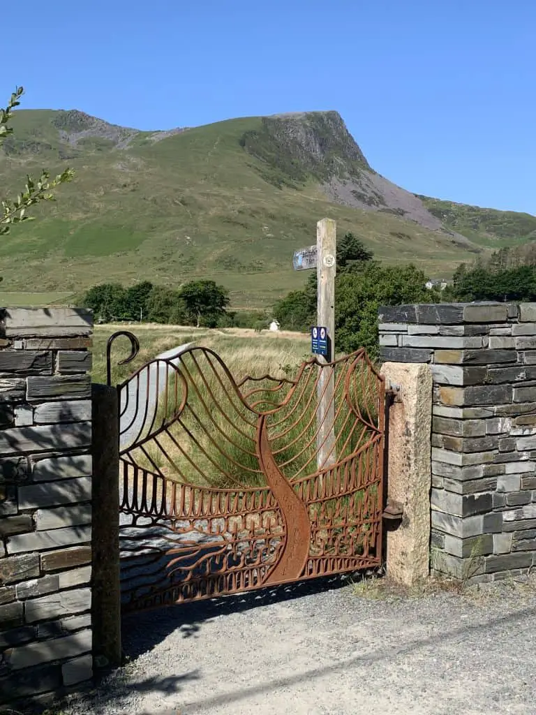
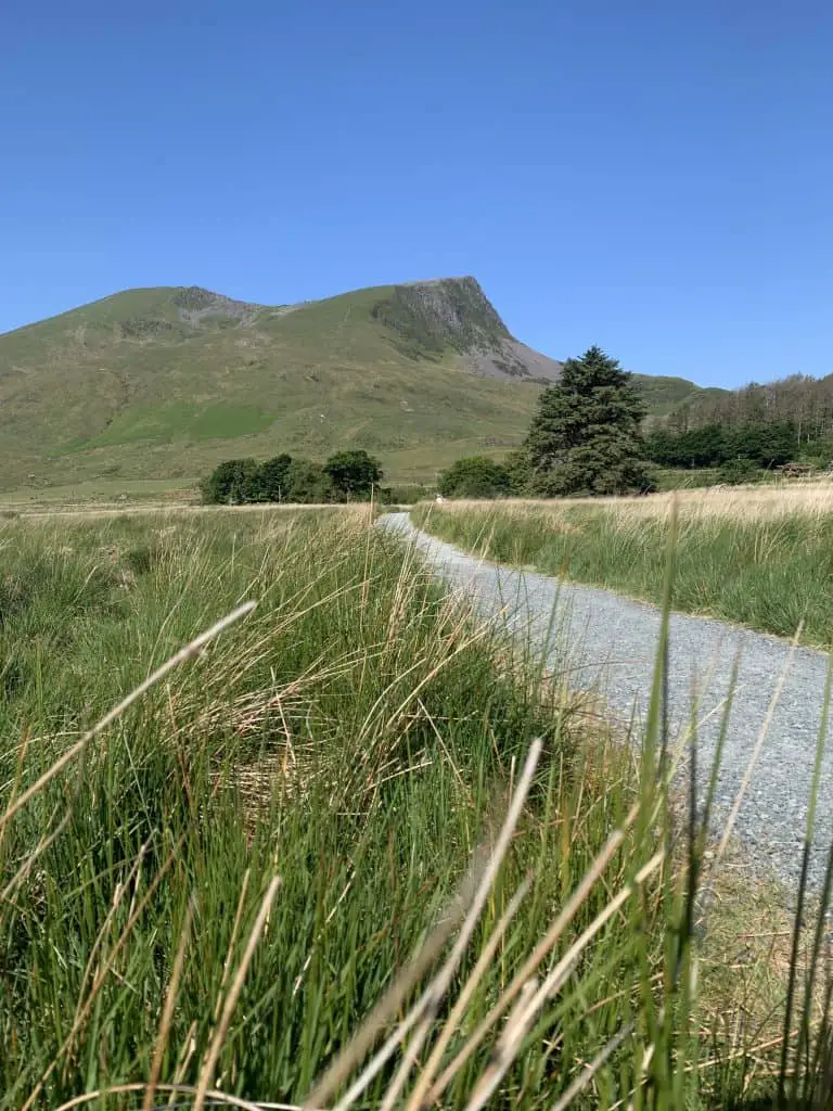
From the Rhyd Ddu car park, cross over the road and pass through the metal gates to start the walk, ignoring everyone else who will likely be heading in the direction of Yr Wyddfa. The first 1km of this walk is a gentle stroll along a gravel path over flat ground, crossing over a delightful bridge and through several gates.
Continue to follow the path as it turns right then left, passing the B4118 layby. In good weather you will see the mountains you’re aiming for.
Finally the climb begins as the trail becomes a grassy path and starts its way up the mountainside. The first summit of the day is Y Garn, which is not to be confused with a mountain of the same name in the Glyderau range. (Read about hiking Y Garn and the Devil’s Kitchen here)
The hike to this first peak is quite steep in places, making it deceptively hard going. The path is highly eroded and is a combination of a dirt track interspersed with sections of loose rock. Take a breath here and there to admire the views of Llyn y Gadair and the Snowdon Massif behind you.


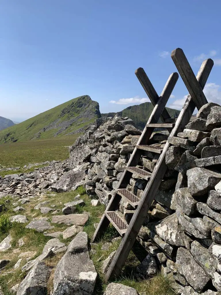
The top section of Y Garn is a boulder field, however the worst of this can be avoided through skirting around to the left, before swinging back around to the right to meet the wooden stile that climbs over a beautiful stone wall. Just another 100m beyond the wall will put you at the top of Y Garn, with the opportunity to admire views in all directions.

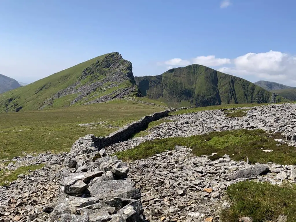
Looking to the southwest you will be able to see the ridge laid out ahead of you, with the shoulder of Mynydd Drws-y-Coed providing the next climb of the day.
From the summit there is a faint path heading in the direction of Mynydd Drws-y-Coed through the stone shelter. Follow the path and stone wall as it leads to the only technical part of of the Nantlle traverse.

Although from a distance the ascent of Mynydd Drws-y-Coed seems quite imposing, the scrambling here isn’t too difficult. Tricky sections can be mostly avoided through choosing options to the left of the ridge, away from the exposed edges on the right.
There are small sections of path broken up with large boulders and a few slabs that require navigating over, but a route to the top is straight forward to pick out.


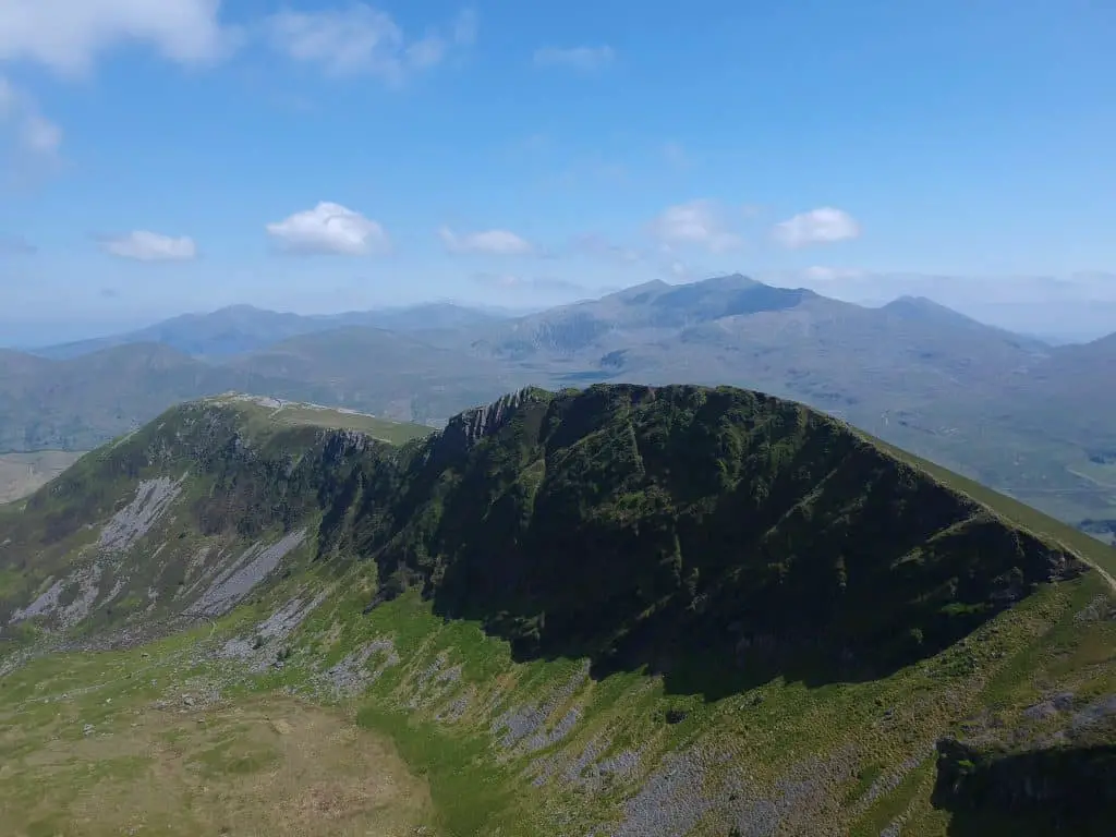
This grade 1 scramble is perfect for beginners but disappointingly short for seasoned scramblers and before too long you will be at the top of the second summit of the day. Again there are fabulous views looking east towards Yr Wyddfa as well as looking back down the ridge to Y Garn and westerly towards the dramatic escarpment of Trum y Ddysgl.

Continuing along the path there is a short decent to the saddle between the two hills before the next section of climbing begins. If desired, the summit of Trum u Ddysgl can be avoided by taking the left-hand fork of the path, however for the best views stay right to stay up on the ridge.
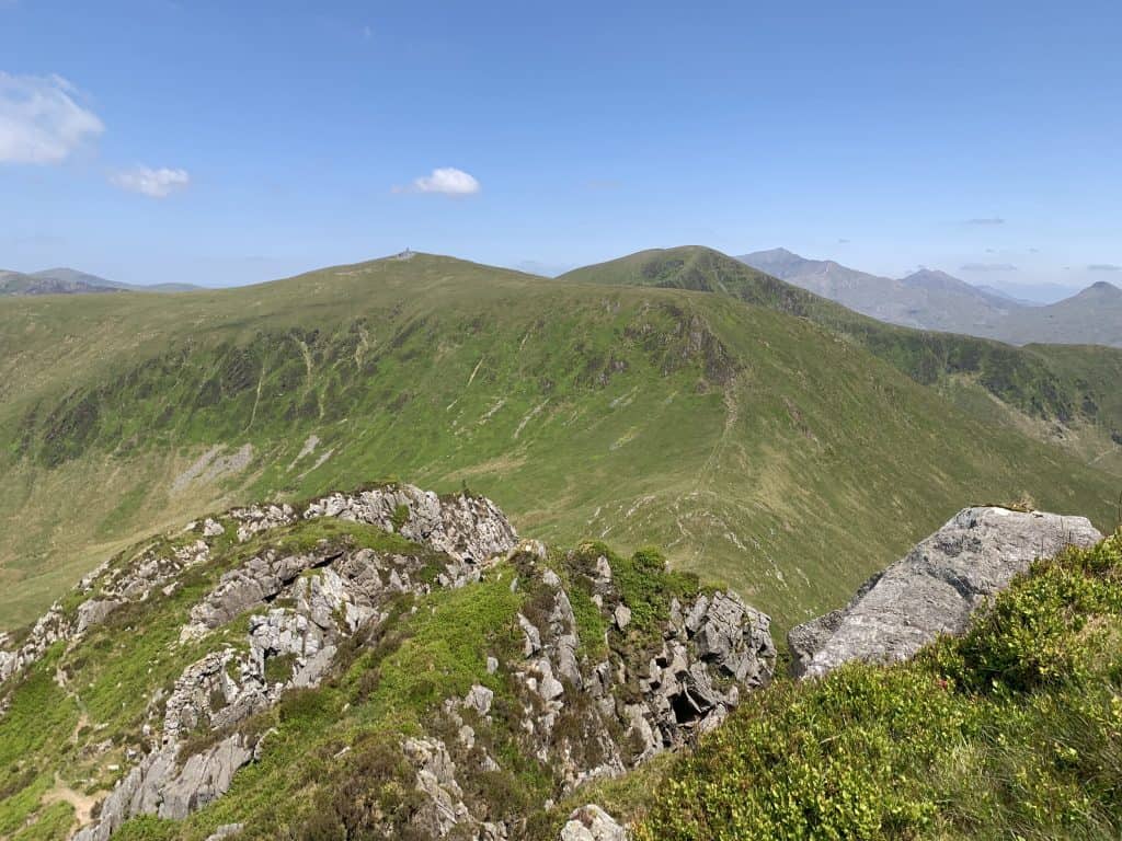
It’s just a short ascent to the grassy top of Trum y Ddysgl which marks the third peak of the day. Soak up the views over Mynydd Drws-y-Coed and Y Garn as well as the Yr Wyddfa Massif beyond. The pointy peak of Yr Wyddfa is easy identifiable as the highest peak in the area. To the southwest you can see the next two peaks along the Nantlle Ridge, with Mynydd Tal-y-Mignedd first in line.


To continue the walk, head along the flat ridge from Trum y Ddysgl and follow the path as it turns down to the right. The grassy path gives way to a slightly exposed downhill rocky section and a delightful walk along the narrow ridge. However, this is short-lived and the wide, grassy path returns as it starts the climb up to the next peak.


Cross over the stone wall via the stile and continue uphill to the fourth peak which is marked by an obelisk. This stone monument on Mynydd Tal-y-Mignedd was built in 1887 to commemorate Queen Victoria’s Diamond Jubliee.
Views here open up more over the Irish Sea, as well as offering a glimpse of the next big challenge that lies ahead – the highest peak in the Nantlle range, Craig Cwm Silyn.

Mynydd Tal-y-Mignedd is a great spot for lunch, refuelling in readiness for the toughest uphill section of the Nantlle ridge. From the obelisk continue along the path to the southwest along the wide, grassy ridge. After 500m the gentle slope again becomes a steep, rocky decent but once more this doesn’t last too long.
Follow alongside the fence as the grassy path links the two mountains and the climbing begins once more. There are two options here. Option one is to stay left and take the steeper, more direct route to the summit. Option two is to stay right and continue around the ridge, before taking a slightly less steep route onto the ridge from the northern bowl.

Once on the ridge, the climbing is continuous and unforgiving on tired legs, but dramatic views off to the left provide welcome opportunities for regular photo stops. The top section of Craig Cwm Silyn is rocky with boulders to navigate over, however keeping roughly to the left will ultimately bring you out on top if you lose the path.
The first rock pile and stone building is the true summit of Criag Cwm Silyn, although it appears to stretch on further. As this peak is quite broad and long, the views are best enjoyed before reaching the peak so take time to appreciate how far you’ve come before pushing for the summit. Here you can see the whole of Eryri stretching out to the west.


The easiest path to leave the summit, stays to the left of the bouldery, broad ridge. Continue across onto the grass as the path leads to another stone wall which requires crossing. At this point the path becomes faint and traverses boggy sections. If unsure or in poor visibility, hug the stone wall on your left which climbs to the summit of the penultimate peak, Garnedd Goch.

The climb to this peak is gentle and brief and the summit itself is somewhat underwhelming. However the views back along the ridge are still impressive and it’s worth taking a little moment to admire the scenery, before moving onto the final challenge of the day.

Leave the summit along the grassy path as it continues alongside the wall. The grassy path quickly becomes steep with loose rocks as it zigs-zags down the hill. After 500m there is a T-junction. Right leads down into Cwm Dulyn, towards Nebo and left continues along the route to the final peak.
Many people will neglect to climb the final peak of Mynydd Craig Goch on a Nantlle Ridge walk because it’s not much of a ridge walk beyond Garnedd Goch. However, to complete the range one final push is required.
Turn left, pass through the stone wall and contour around the side of the mountain to Bwlch Cwm Dulyn. Continue around onto a grassy plateau and enjoy the easy walking for this final stretch. Once across the plateau, there is a brief climb up through the rocks to reach the summit of Mynydd Craig Goch which is the seventh and final peak of the day.
This summit is again rocky with a stone wall passing between the rock piles and a flag marking the most westerly peak of the Nantlle Ridge. This is the lowest peak of the day with the best views looking west over the Llyn Peninsula.

Now it’s time to make the final descent into the valley. The path leaves the summit in a northwesterly direction, heading down towards Llyn Cwmdulyn. This could be tricky to find in poor weather and some compass work maybe required.
Conditions were dry on my visit but the amount of Cottongrass in the area suggests this could be a boggy affair in the wetter months. When the path forks, either trail ultimately leads to the final destination, which is the most westerly side of the lake.

The path is gradual and grassy, making for a pleasant descent to finish the day. Once at the lakeside, follow the gravel path to the car park to be reunited with your car. Alternatively, follow the tarmac road which leads into Nebo and call for a taxi.
Read Next
- The 10 Best Hiking Routes In Snowdonia
- Top Locations For Photography in North Wales
- The Best Castles To Visit in North Wales
Where to Stay After Your Walk
Tal y Mignedd campsite is a great little campsite located between the start and finish points of this Nantlle walk. The toilets and showers are modern and clean, whilst views looking down the valley are beautiful. Perfect if you have your own camping gear or campervan.
If you prefer to spend a few nights in Nebo to save a little car ferrying at the start of the day, then try Hedd Wen holiday home. This modern cottage has everything you need to relax after a long day in the hills.
For those on a budget or if you’re for something a little quirky, try the Stunning Caravan – Y Dryll Bach Beddgelert. This modern caravan has all the facilities you need whilst being located in the gorgeous village of Beddgelert.
What to Take on a Nantlle Ridge Walk
- Waterproofs – of course, it’s Wales and we get lots of rain!
- Food & water – filtering water bottles are very handy for safely refilling in streams and rivers. You can read more about filtering water bottles in this guide. Psst! I’ve secured a deal for all readers of this website. Simply use the code WWG15 at checkout to get a 15% discount off all Water-to-go bottles and filters.
- Hat, gloves and warm layers for the summits
- Quality hiking boots are a must
- The relevant map and compass, and the ability to use them!
- A first aid kit for hiking
- These paths are also marked on various mapping apps. A great free option is maps.me, although the free features have now become limited. I have an annual subscription to OS which means I have access to all UK OS maps on my mobile. I can definitely recommend it if you’re a regular hiker/walker.
These are just some of the essentials, but for a complete list of things to take on a hike in Wales, take a look at this guide!
Nantlle Ridge Walk Summary
The Nantlle Ridge is a range of mountains in Eryri National Park. A traverse of this ridge can be walked in either direction but involves two cars or the use of public transportation. The full traverse is 14.5km in length and gains over 1000m in height. In this guide I have provided an in depth route description, with start and finish locations and full trail stats.
The Nantlle Ridge beckons those who seek solace in nature’s embrace, promising an adventure that surpasses expectations. Lace up your boots, embrace the unknown and lose yourself in the ethereal beauty of Snowdonia’s hidden gem!
Join My Newsletter Today and Stay Updated With the Latest Guides!